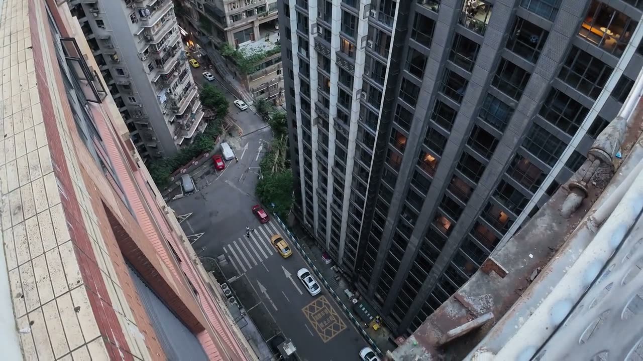
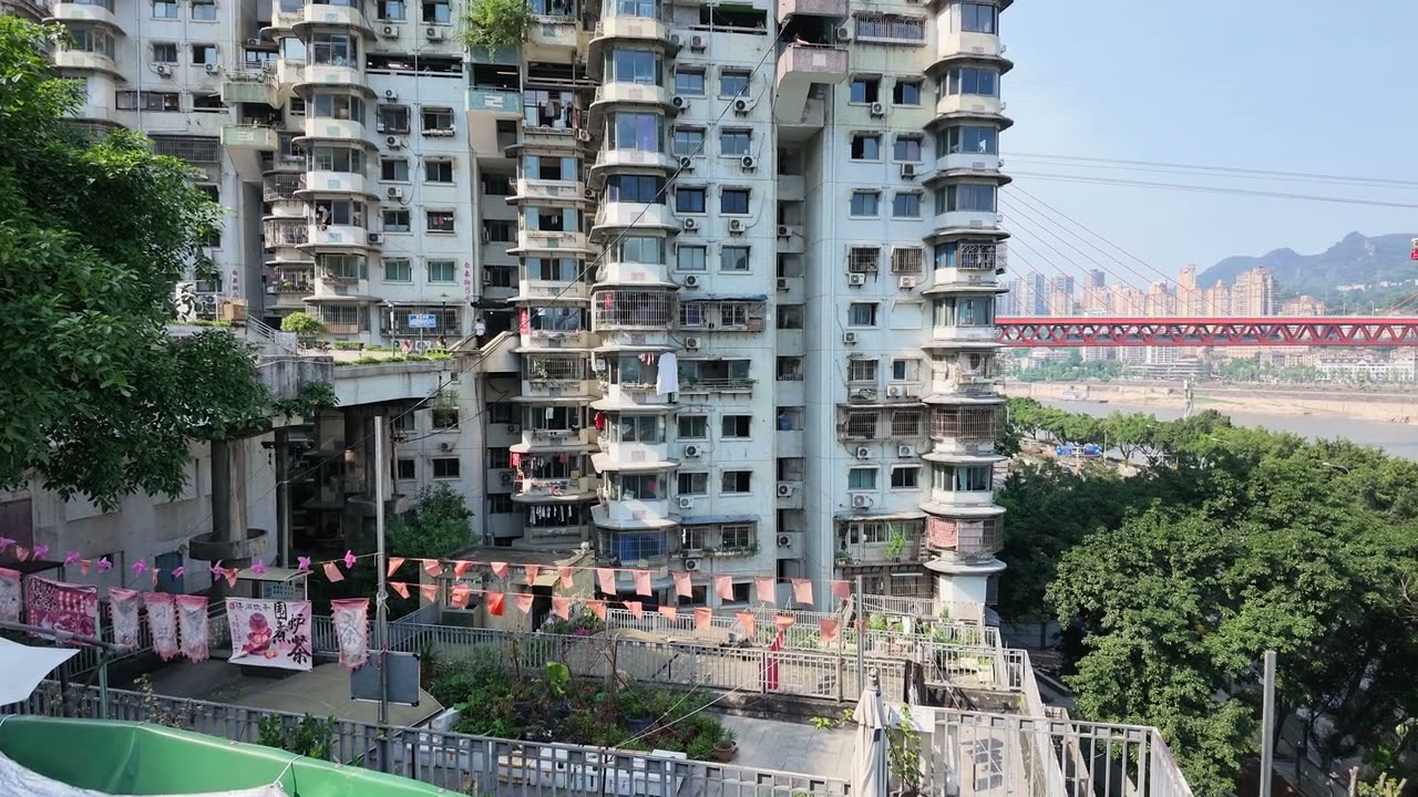
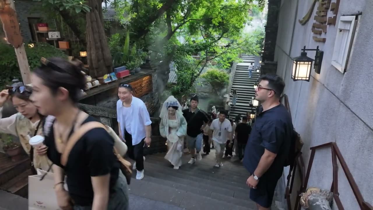
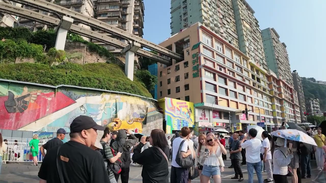
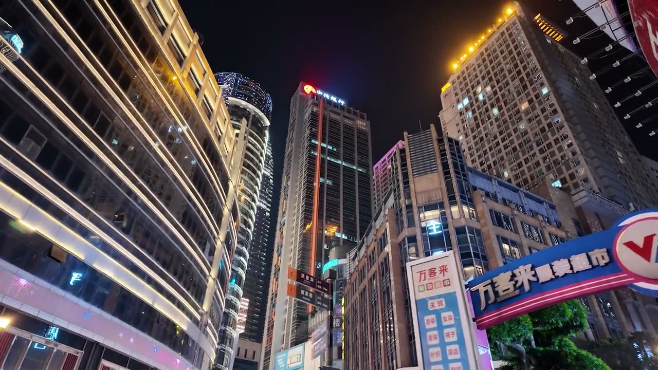
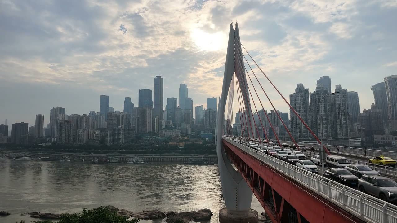
Everyone films the same four blocks. The city is underneath them.
Fact check. The internet says Chongqing is the largest city in the world (32 million people), the most surveilled (2.5 million cameras) and the “8D city”. All three are true in a way that makes them false. The 32 million live inside a border drawn in 1997 around an area the size of Austria; the continuous city holds roughly ten million. The camera count is a national per-capita estimate applied to the largest administrative population in China, which is how Chongqing “won” a ranking nobody measured. And 8D was a netizen’s joke in the spring of 2017 about one interchange. We audited every number in the film against the municipal record. Where the record disagrees with what we said on camera, this page says so.
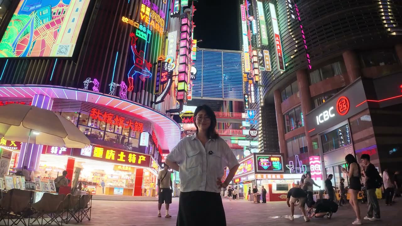
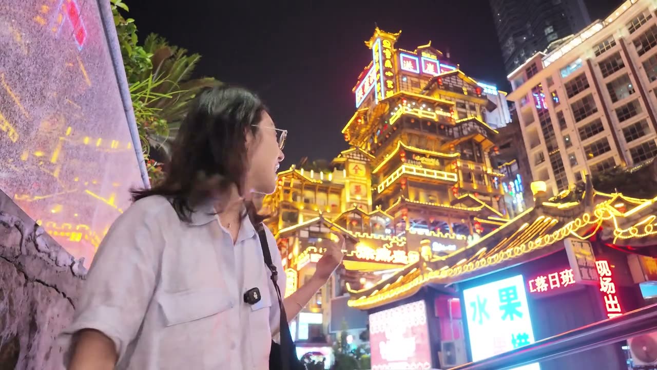
I went to Chongqing for the version of it that lives on my phone. The train that runs through a block of flats. The cliff of lanterns that looks like a Ghibli film. The wall of neon with a Spider-Man on it. That version exists, and it is about four blocks wide. Everything else about the city is stranger than the pictures, and almost none of it is in them.
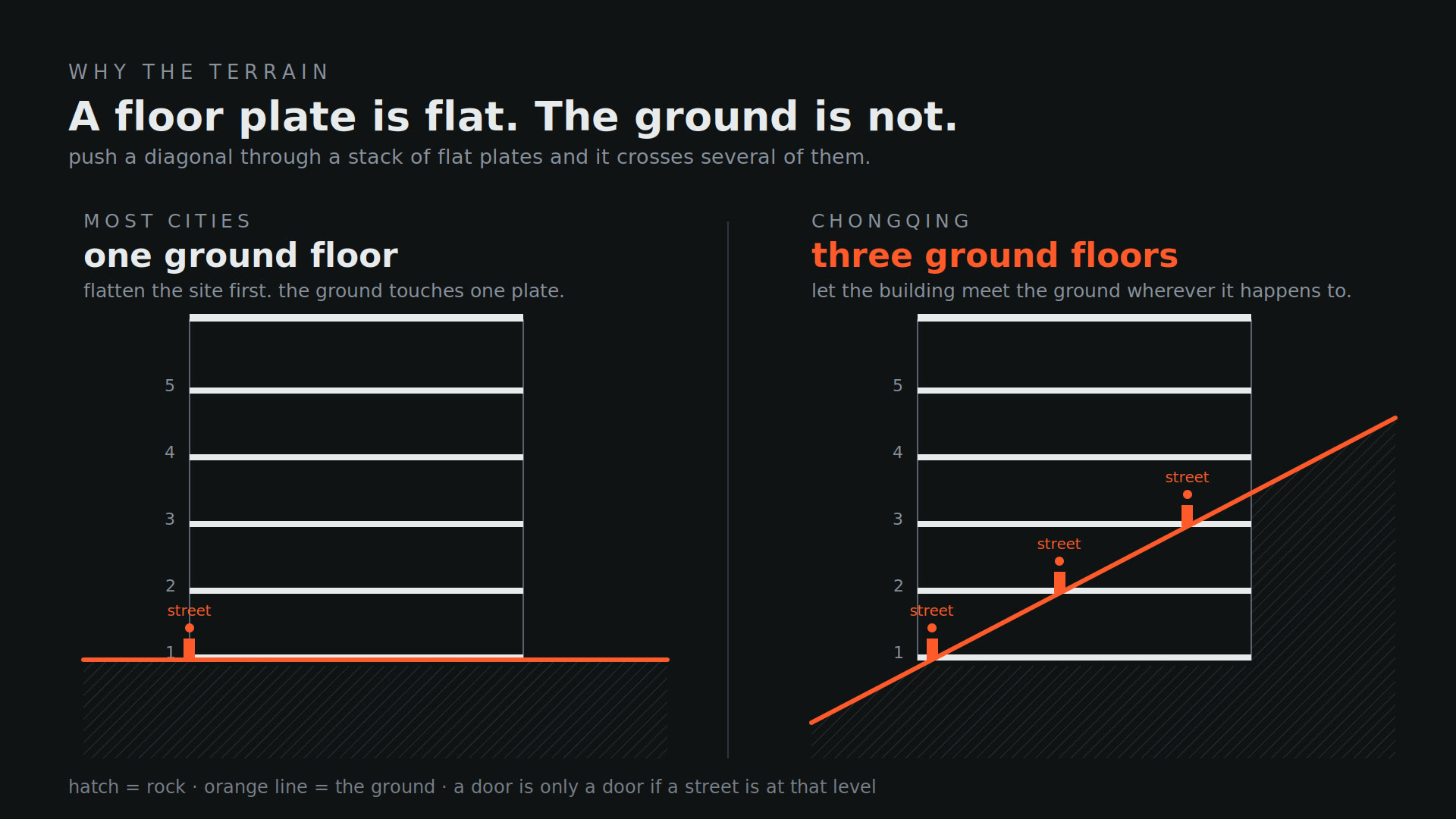
The strangeness is the ground. In a normal city the ground is one thing: the line you count floors from, the surface everyone shares, the datum. Chongqing is squeezed between two rivers on a peninsula that climbs more than two hundred metres from the water, and it has been building on that slope since it was walled in 1371. When you push a hillside through a stack of flat floor plates, every plate the hill touches becomes a ground floor. A single housing block here has three front doors on three different streets, ten and fifteen storeys apart. A public square sits on the twenty-second floor. The datum is not gone; it has multiplied.
That is the shape. The size came from somewhere else. A war made this the capital of China for eight years and dragged whole factories up the Yangtze on boats. A dam turned a city into a province-sized municipality with its own line to Beijing. A national programme called Go West paid for a monorail, and when the monorail met a developer’s tower on a plot with a cliff on one side and a river on the other, nobody moved. They built both. On one plot. The picture that went round the world is a compromise; the engineer’s word for it was jiangjiu, making do.
And then the surface. The neon was installed around 2020, for marketing, on a shopping centre. The cliff of lanterns opened in 2006 as a single development. The city that looks the most like the future is, in its most photographed places, the newest thing in it. We went to stand in all of it, and then we checked all of it: the raid counts, the death tolls, the escalator’s height, the floor the platform is on, the year the border moved.
The terrain set the shape. The state set the size. The picture set the surface.
The argument of the film, in one line
Three things sit at the centre of what we found: a ground that multiplied, a line that was redrawn, and a picture that started building the city that made it. Each is an answer to the question the film keeps circling: what happens to a place when the copy of it becomes worth more than the place?
The worldbuilder’s frame
Cities grow outward from the river until something stops them. In Chongqing what stopped them was never the river; it was the ground itself, folded so steeply between two rivers that the city stopped having one ground at all. Everything else here — the stairs, the walk-up towers with three front doors, the train through the flats, the neon put up for the phones — follows from that one bent line.
Maps and photographs old enough to belong to everyone, the drawings we made, the frames we kept, and the research that didn’t survive the edit. Each scrap carries a note on why it is here.
Archive · c.1860–86
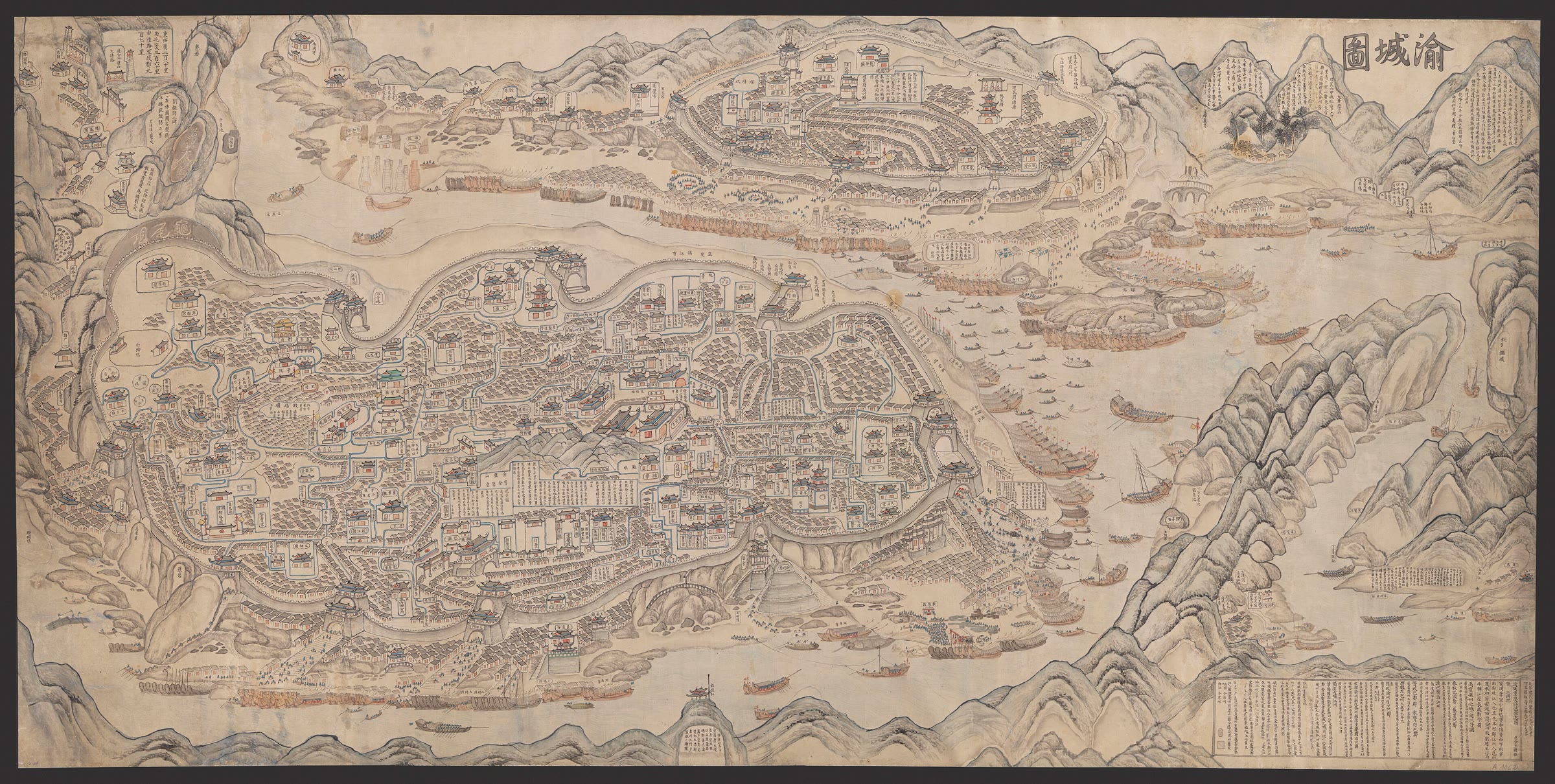
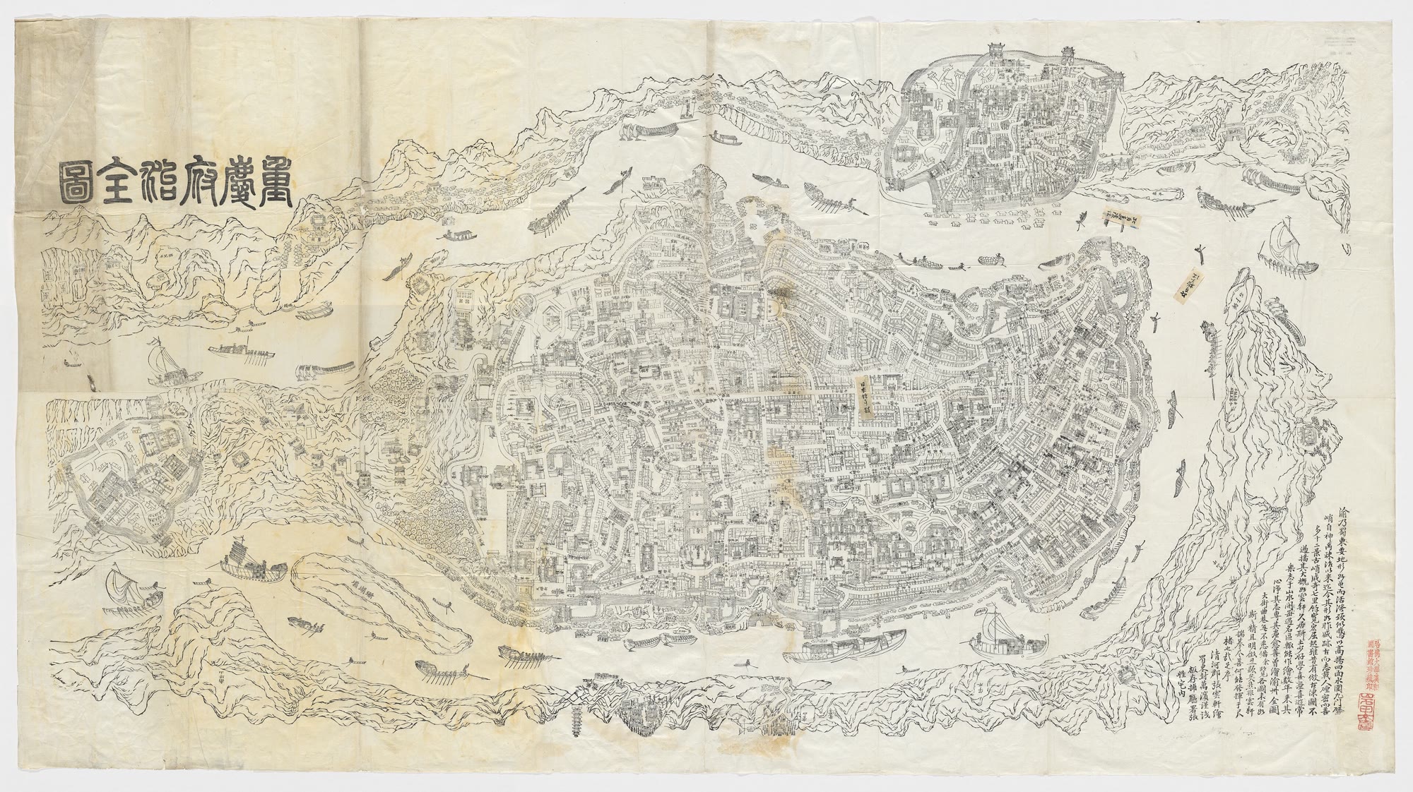
The city as a scroll渝城图
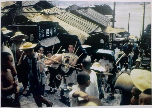
Painted between the 1860s and 1880s and kept at the Bibliothèque nationale de France. Every gate, every wharf, hundreds of porters and two hundred boats. This is the upper city and the lower city before anyone had a word for 8D. I could look at it for an hour.
BnF, cote GE A 1062 (RES) · public domain · via shuge.org
Our drawing
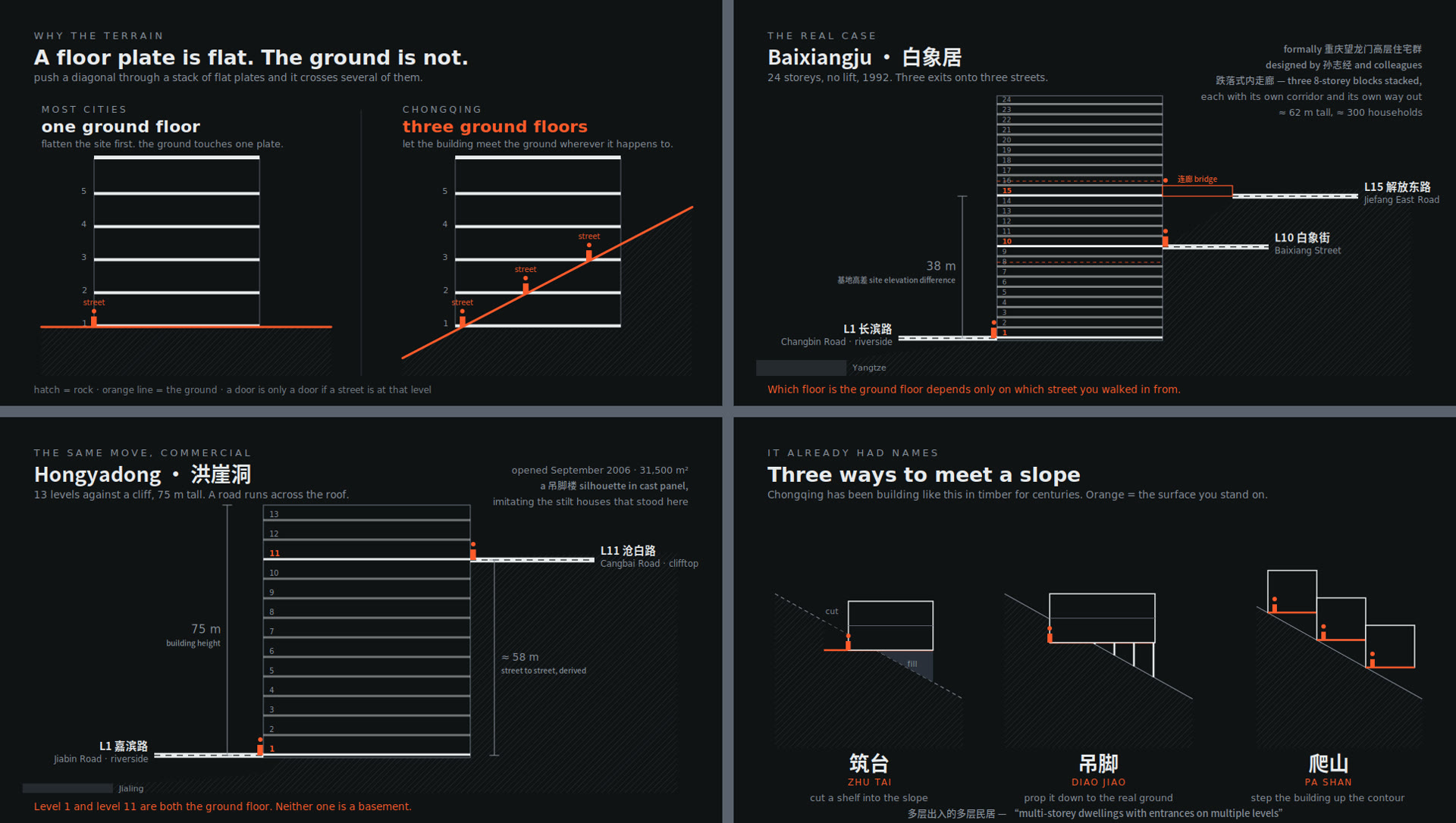
The multiple-ground sheet
Four panels drawn to sourced dimensions: the mechanism, Baixiangju, Hongyadong, the vernacular moves. Anything we had to derive carries a ≈ on the drawing itself. This sheet is the argument of the film in one page.
Nollistudio, Aug 2026 · live SVG
Archive · 1926–28
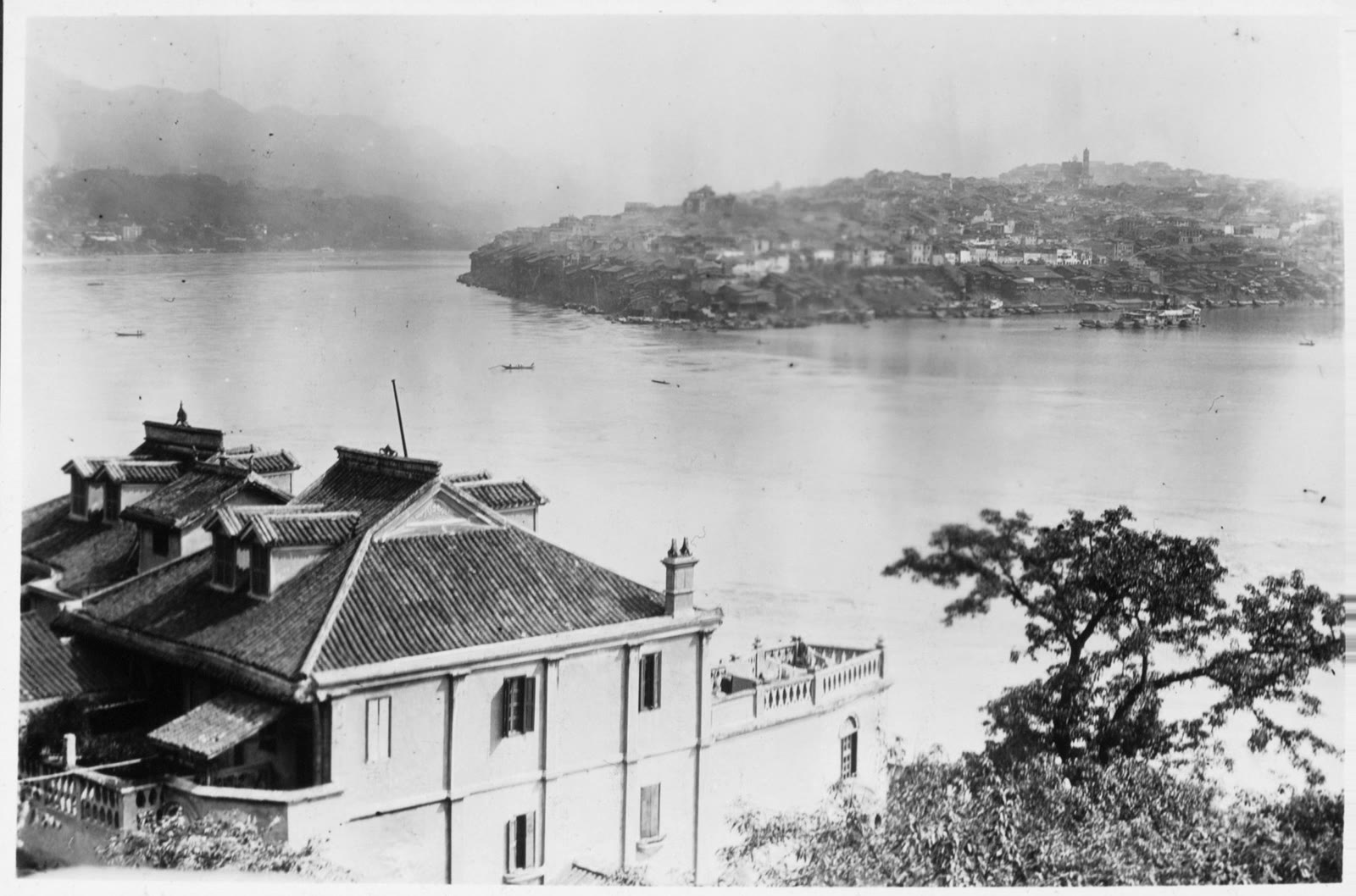
The stepped city, 1926
A Japanese photographic survey described the town “crawling up the hill like a staircase”, with red-tiled foreign houses halfway up. Fifteen years later the same country’s bombers were using the staircase as a target.
亜細亜大観, vol. 14 · public domain · Wikimedia Commons
Our film · June 2026
The shot everyone came for
Our frame of the train going into the flats. Every day a crowd stands across the road to take this exact picture, and the city built a viewing platform so they could take it better. I took it too. Chapter 8 is about why the building looks like this.
Nollistudio, Liziba, 3 June 2026
Archive · 16 June 1940
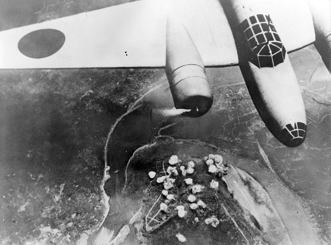
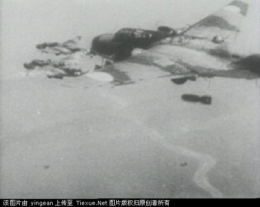
Bombers over Chungking
The Asahi Shimbun’s own photograph of a Ki-21 over the city. The raids came in the clear months; in the fog months the theatres opened. Chapter 3 has the numbers, and the ones nobody agrees on.
Asahi Shimbun, 1940 · public domain · Wikimedia Commons
Paper · 2022
The paper that says it in one sentence
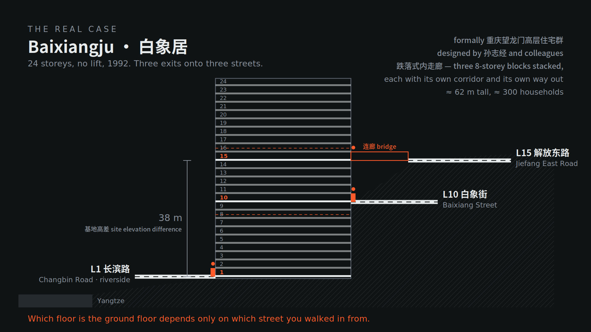
Yi Jin’s open-access paper on Chongqing’s verticality contains the whole multiple-grounds idea in one citable line: residents enter Baixiangju at ground level by the river, through a gate on the 10th floor, or by an entrance on the 15th from the road at the top. Featured in the Sources.
Jin, Y. (2022), Urban Planning 7(4) · CC BY · our drawing
Archive · 1941
Chaotianmen, 1941
The docks at the tip of the peninsula in the year of the tunnel tragedy. The same point of land is now the base of Raffles City, the eight towers with a sailboat on top. Two of the film’s four pictures are standing on this photograph.
Public domain · Wikimedia Commons
Cut · Dami’s thesis
The arrangement
This is the idea I couldn’t fit. A community isn’t just the people in it, it’s the arrangement: the corridor you cross every day, the stall at the bottom of the stairs, the neighbour you pass at the same time each morning. Baixiangju’s corridors made a community nobody designed. It adds two minutes to a film that was already eight over, so I parked it for its own video. The working notes are in the research trail.
Nollistudio, working thesis, Aug 2026
Archive · 1969
Why a weapons plant hid inside a hill
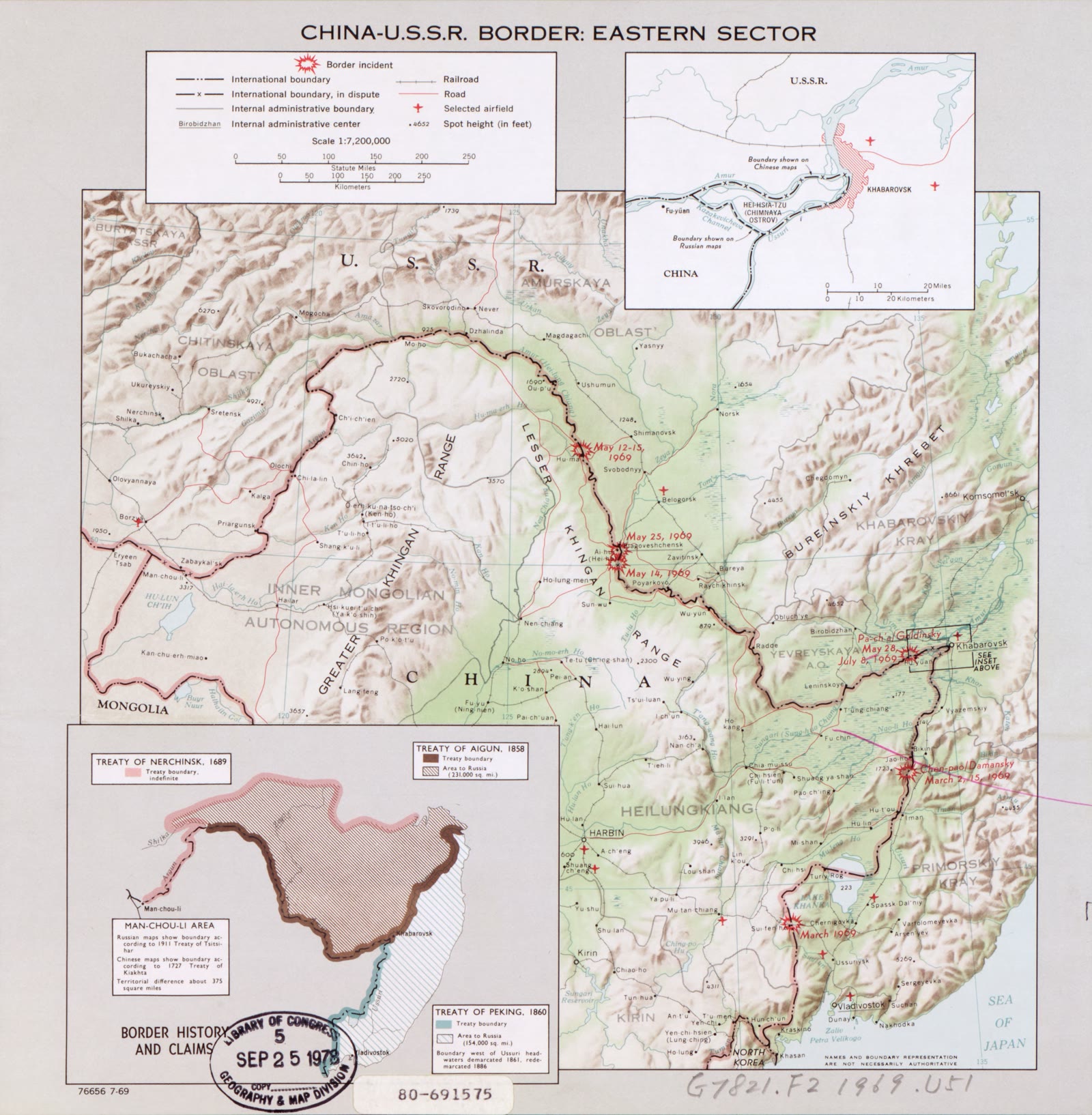
A CIA map of the Sino-Soviet border, drawn in the year of the Zhenbao Island clashes. The tunnels we ate hotpot in were dug in 1973–78 for a munitions plant moved inland where the Soviets couldn’t reach it. Chongqing’s underground has two wars in it, and the film only had time for one.
CIA, 1969 · Library of Congress · public domain
Our drawing
Two cities’ numbers
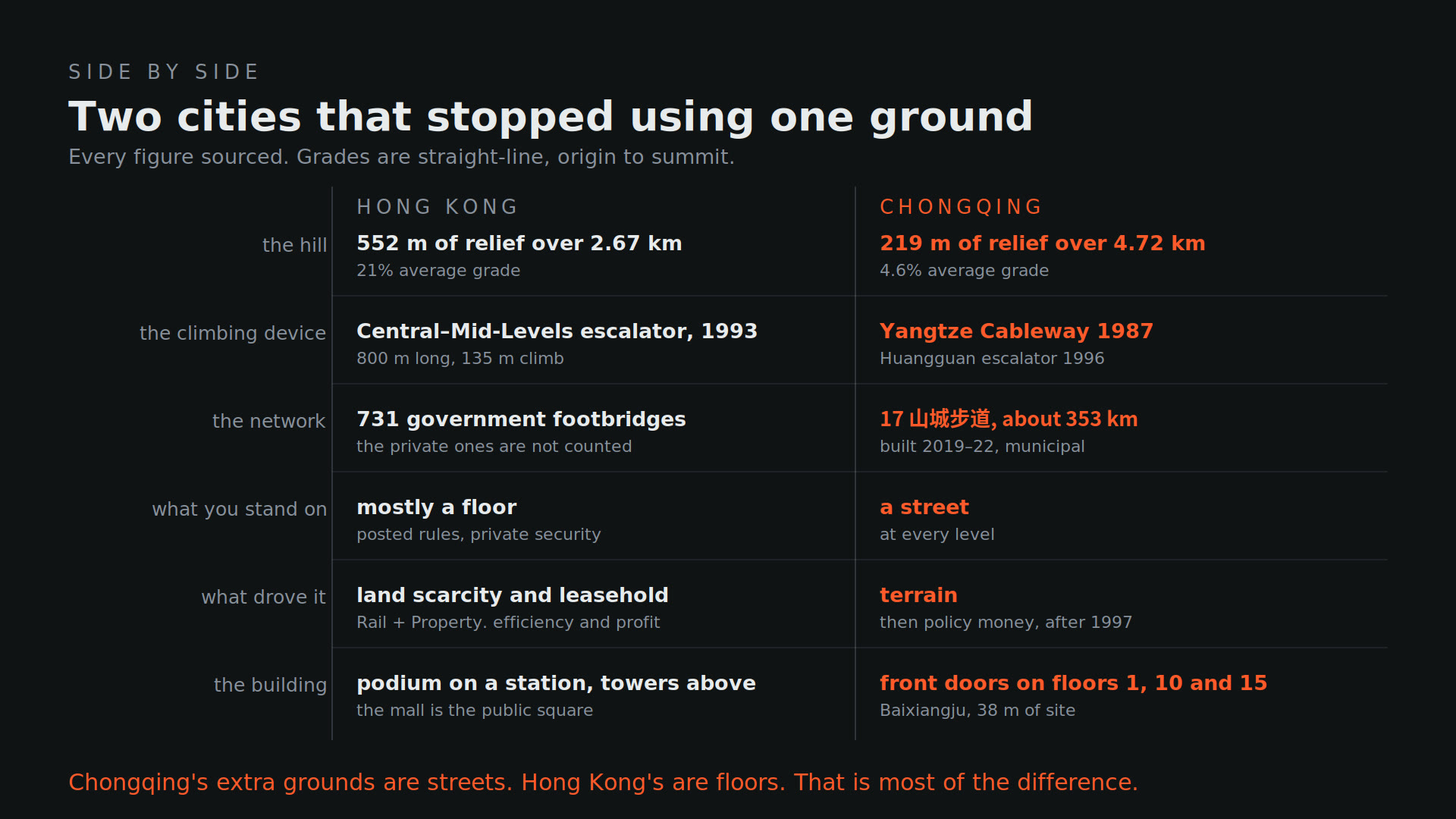
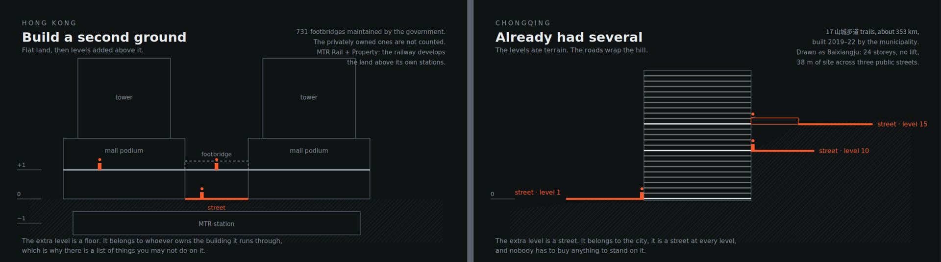
731 government footbridges against 353 kilometres of mountain trails. Hong Kong doesn’t know how many footbridges it has, because most of them belong to somebody. Chongqing can tell you it has seventeen trails, because the city built them. That gap is the best single fact in the comparison.
LegCo reply, May 2025 · Chongqing municipal plan · Nollistudio
Our film · June 2026
The bride on the Eighteen Steps
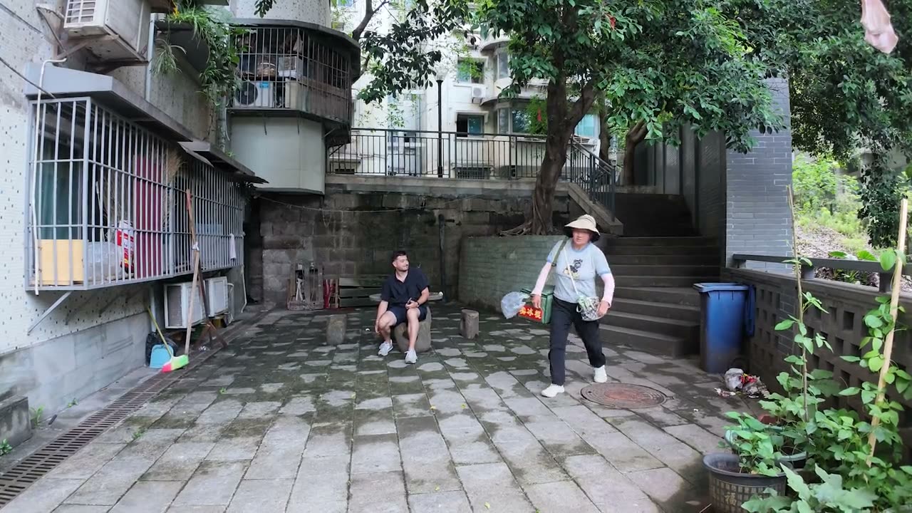
Halfway up Shibati a bride stopped to breathe. Six and a half centuries of climbing in one shot. We kept it in the film for the laugh, and it is the most honest frame we have of what the stairs still are.
Nollistudio, Shibati, 4 June 2026
Archive · 1962
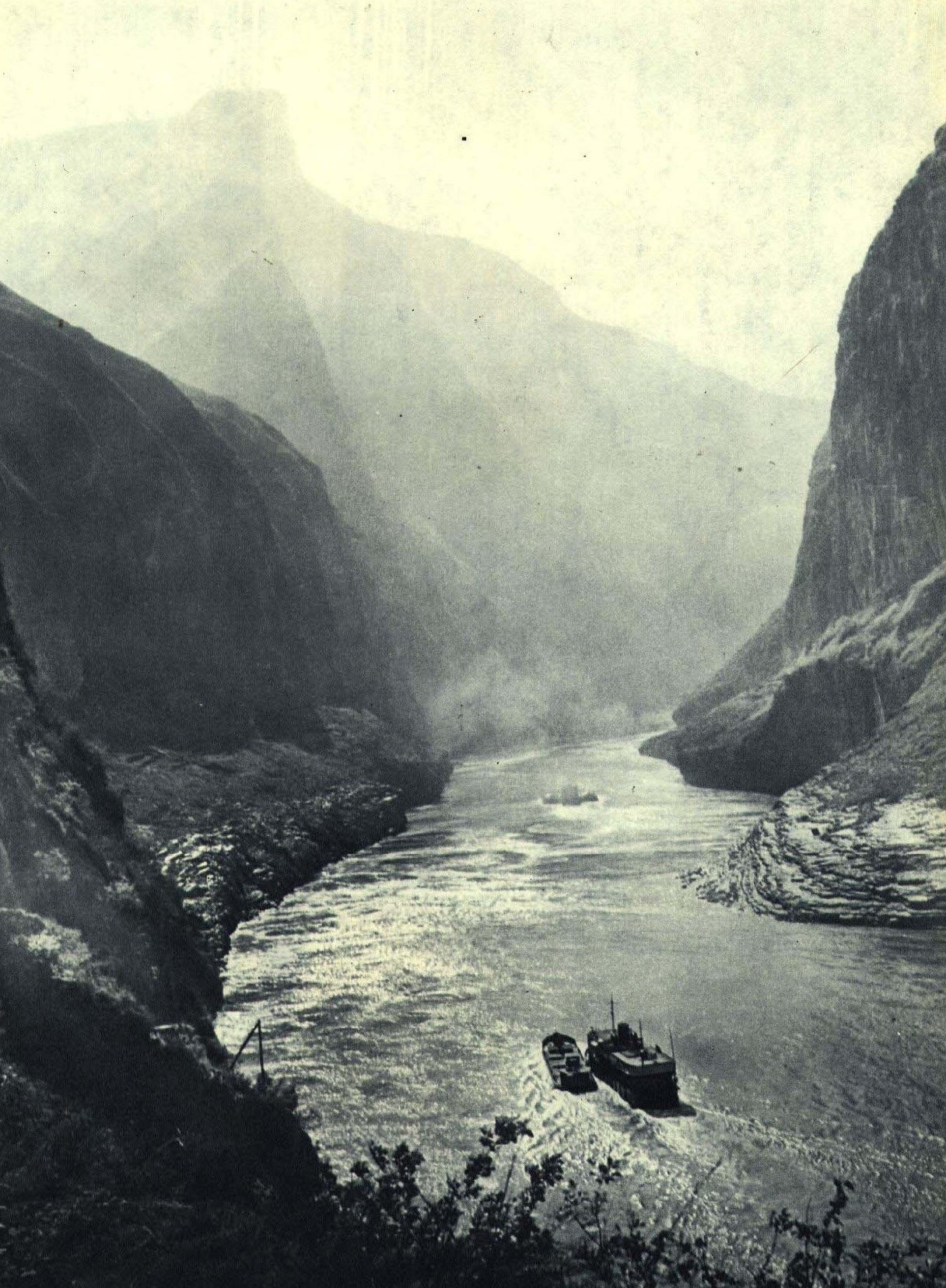
The gorges before the dam
People’s Pictorial, 1962. The water in this frame is sixty-odd metres lower than it is today. The reservoir that replaced it reached its normal pool of 175 metres in 2010 and backs up six hundred kilometres to Chongqing’s own docks. Chapter 4.
人民画报, March 1962 · public domain · Wikimedia Commons
Cut · the escalator
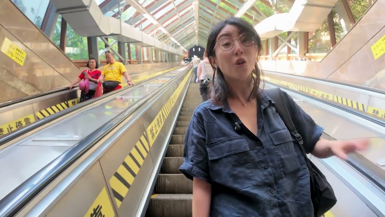
The escalator we nearly cut
112 metres long, 52.7 metres of rise, and the fact that didn’t fit: it was 55 per cent financed from Hong Kong, designed by a Taiwanese practice with a Beijing metallurgy institute and Russian equipment, and it opened in 1996 as the city’s first foreign-funded public facility. A mountain forcing improvised transit, and paying for it with somebody else’s money, ten years before the monorail.
Nollistudio, 4 June 2026 · sources in the research trail
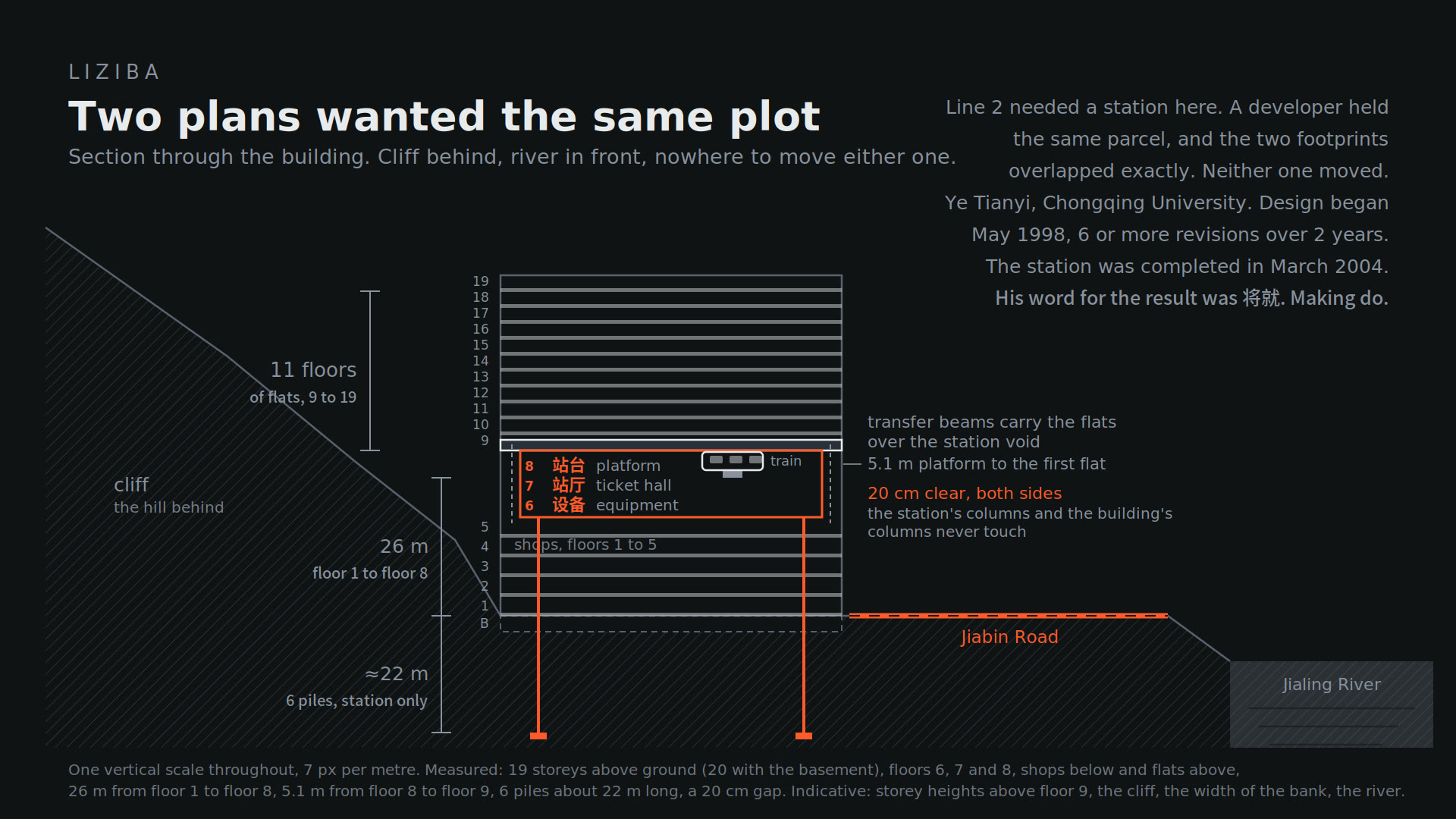
Our drawing
Two plans wanted the same plot
The Liziba section with every measured number and its source, and the indicative ones labelled as indicative. The floor order, 6 concourse, 7 equipment, 8 platform, came from the engineer, not from the diagram we started with. It was wrong. We fixed it before the film.
Nollistudio, Aug 2026 · designer interview, 澎湃
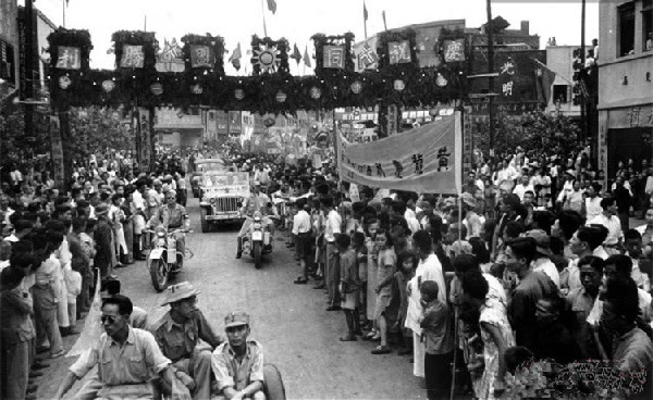
Archive · 3 Sept 1945
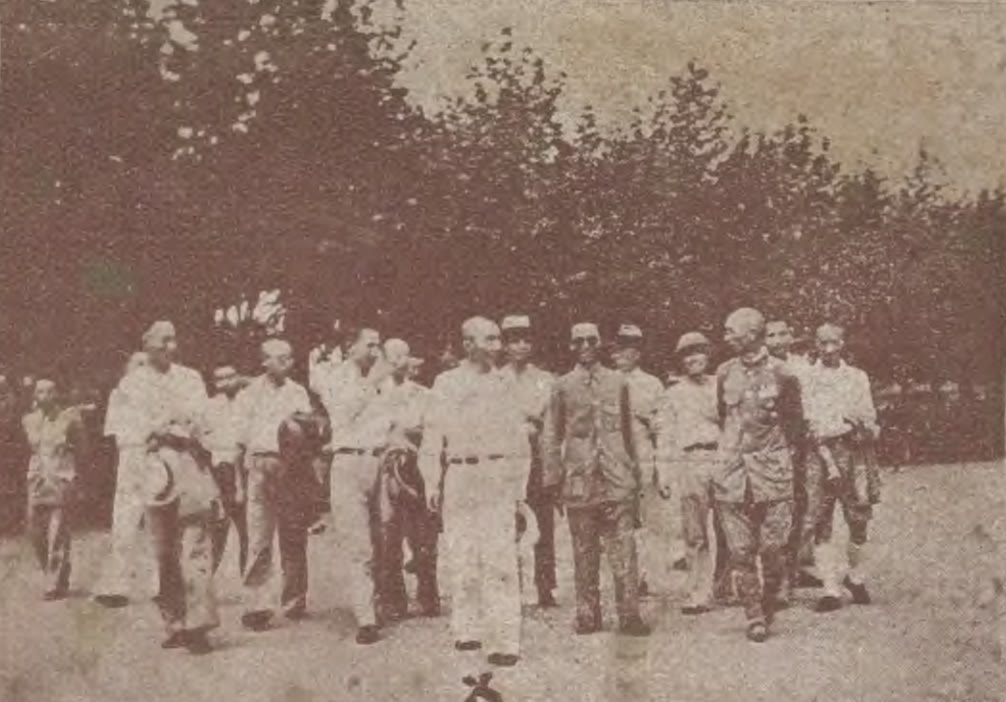
The last day as the capital
Eight years as the capital of China, a fifteen-year run reporting straight to the centre, and then, in 1954, back to being a city inside Sichuan. The film says “fifteen years”. It skips that the fifteen years span two governments and a revolution.
Ministry of Propaganda, Republic of China, 1945 · public domain
Cut · Raffles City
The sailboat on the gate
Raffles City stands on Chaotianmen, the old imperial gate, with a 300-metre “horizontal skyscraper” across four of its towers. When it was announced, people on Weibo and Zhihu said the gate would be forgotten under a Singaporean name. That criticism was in the outline in version 2 and fell out by version 5. It belongs here, because it is a Chinese complaint, not a foreigner’s.
Nollistudio, 6 June 2026 · Roast (2024) for the discourse
Paper · 2017
Hong Kong, grounded
Karl Kullmann argues that Hong Kong isn’t groundless at all, that the 60,000 registered engineered slopes are its real ground and the skyways keep dropping you back onto it. I disagree with about half of it, and it made chapter 6 better than it was.
Kullmann, K. (2017), Places Journal · our drawing
Archive · 1945
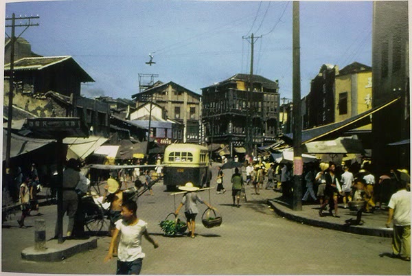
A dock street, 1945
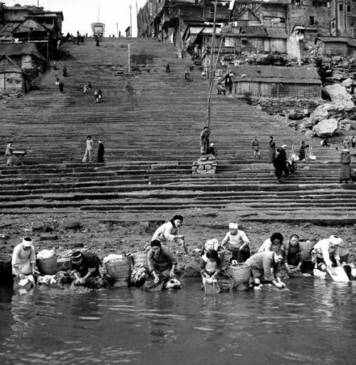
Shot by an American airman near a Chongqing wharf in the last year of the war. Look at the stairs. The crowd on them is the crowd that is still there, now holding phones up at a train.
William L. Dibble, 1945 · public domain · Wikimedia Commons
Our film · June 2026
The edge of the 22nd floor
Kuixinglou. You walk across an ordinary square, reach the railing, and the street is twenty-one storeys down. The local formulation is 「1楼=22楼」, floor one equals floor twenty-two. The script said nineteen for a while. It was wrong; the fact-check caught it.
Nollistudio, 3 June 2026
Our film · June 2026
Two rivers, one colour each两江
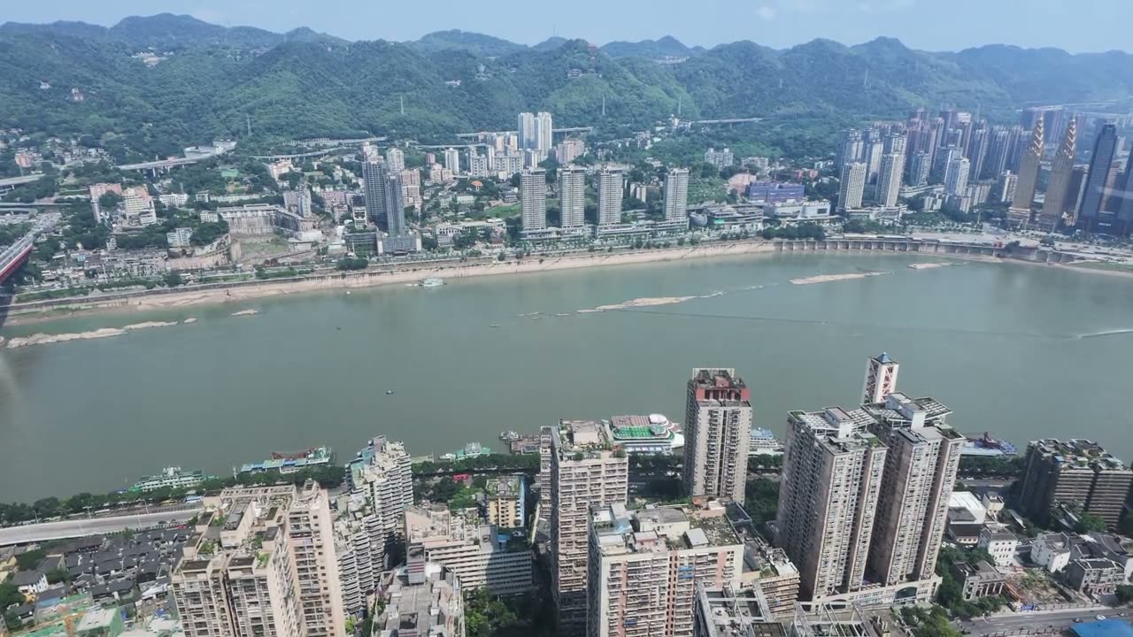
From the Crystal on top of Raffles City, 250 metres up: the Jialing coming in from the left, the Yangtze from the right, and the line where the green water meets the brown. Everything in chapter 2 is in this one frame, including why the capital came here.
Nollistudio, 6 June 2026
Our film · June 2026
The geometry, not the neon
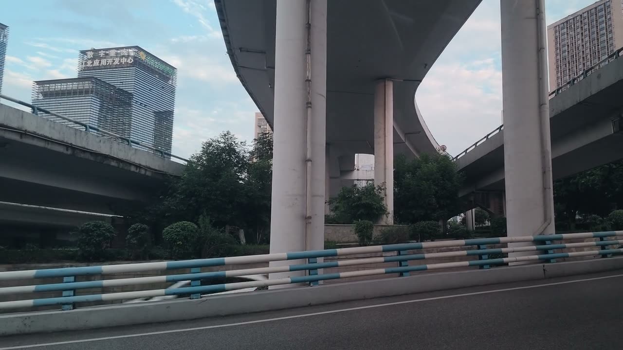
Ramps stacked over one road on the way to the tunnel restaurant. This is the Chongqing I came to film and nearly missed: concrete curves, no signs, imposing at any hour. The 8D interchange everyone posts is the same idea with more ramps.
Nollistudio, 5 June 2026
Our film · June 2026
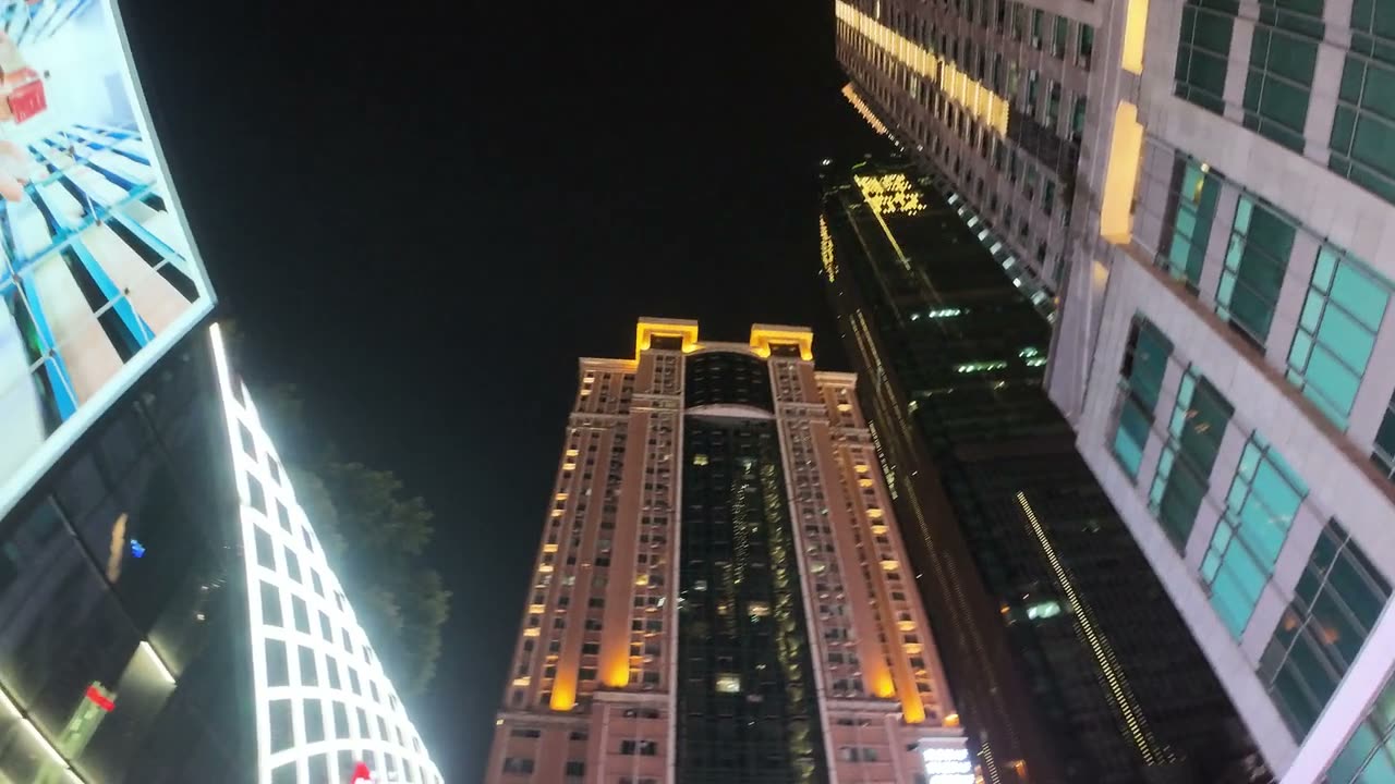
Looking up at Jiefangbei
The towers around the monument at night, from the ground. No neon in this frame, only lit floor plates and a crown. If the film has a visual thesis it is this one: the imposing part of the city is its geometry.
Nollistudio, 3 June 2026
Our film · June 2026
The wall, from the south bank
Longmenhao, the old street on the south bank, is where the peninsula reads as a wall: the Dongshuimen bridge, the towers behind it, and in the foreground the tiled roofs that were here before any of them.
Nollistudio, 5 June 2026
洞
一Chapter 01 · The Mountain
The shelter
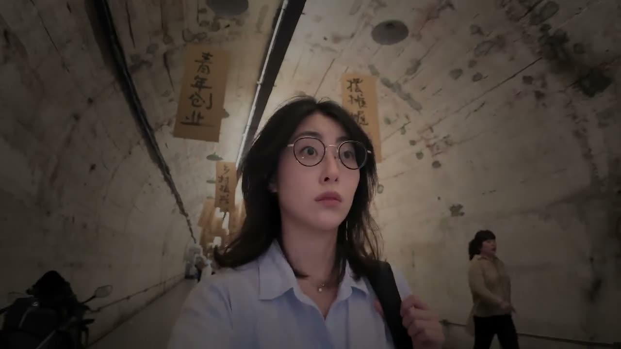
The cyberpunk city sits on top of an underground one. The film starts in it, eating hotpot.
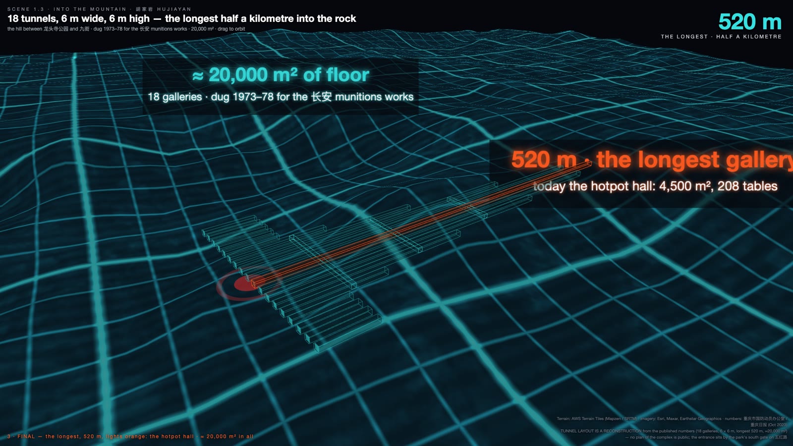
The restaurant is a tunnel. Eighteen of them, each six metres wide and six metres high, the longest running 520 metres straight into the rock, about 20,000 square metres of floor in all.† It is the most famous of the city’s shelter conversions and it was not dug for the war Chongqing is famous for. It was dug between 1973 and 1978 for the Chang’an munitions plant, in the years after the Zhenbao Island clashes with the Soviet Union, when China moved its defence industry into the mountainous interior and, where it could, underground.† Two wars are under this city. The film only had time for one.
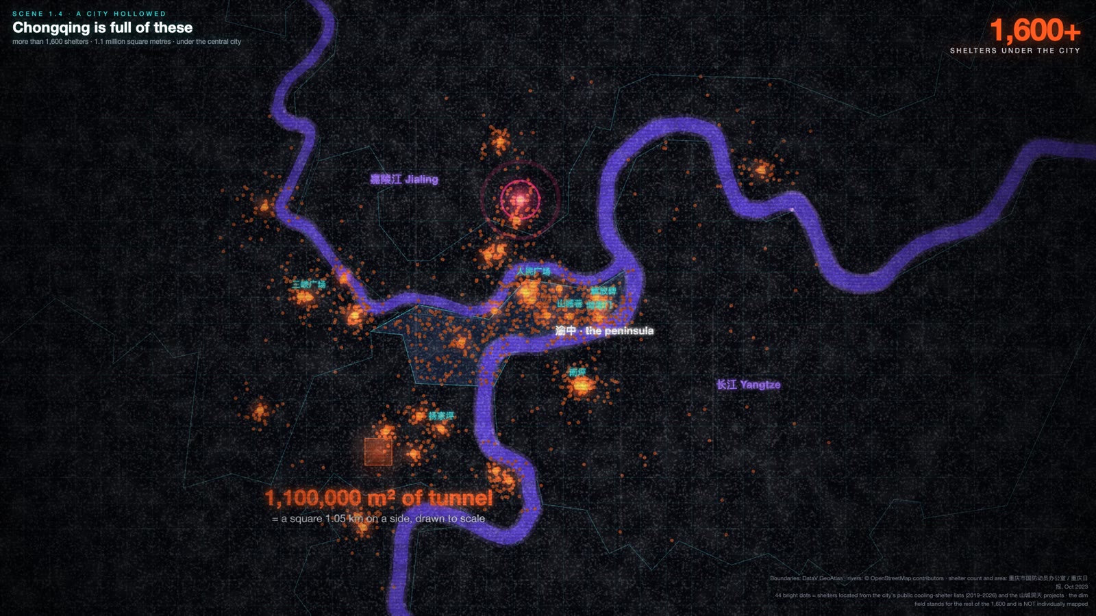
The municipal defence office counts more than 1,600 civil-defence shelters in Chongqing, about 1.1 million square metres of them.† An earlier draft of the script said sixteen thousand. It was off by a factor of ten, which is the kind of number that survives because it sounds right for a city this size. The right number is still extraordinary: a million square metres of hollow, most of it dug by hand under a city that was being bombed while it dug.
18tunnels in the hotpot complex洞
6 × 6 meach gallery, wide and high
520 mthe longest, into the rock
1,600+shelters under the city
1.1 M m²of tunnel, municipal count 2023
What the film could not show is what the shelters have become. Every summer the city opens hundreds of them as public cooling rooms and publishes the addresses; the lists have come out every year since 2019.† Fifteen of the larger caves have been converted under a programme with a name that translates roughly as “mountain-city cave heavens”, into hotpot halls, car parks, bookshops, wine cellars, a museum, and in 2024 those fifteen earned about sixty million yuan.† The war tunnels are a business now. Hold on to that; the same thing happens to the neon and to the cliff of lanterns, and the film ends on it.
Deeper — the second war under the city
The Third Front was the programme, begun in 1964 and wound down around 1980, that relocated strategic industry away from the coast and the Soviet border into the interior provinces, Sichuan above all. Factories went into valleys, behind ridges and into hillsides on purpose, so that they could not be found or hit. The Chang’an plant’s tunnels are one small piece of it. There is almost no open archival photography of the programme, which is why the film uses the room itself as the evidence and why the Atlas carries a border map instead of a factory.
A gallery, empty. Our footage, 5 June 2026. Six metres wide, six high, and the longest of them runs 520 metres into the rock.
The eighteen galleries, reconstructed. No plan of the complex is public; the layout is ours, drawn from the published lengths and the terrain. The orange tube is the hall with 208 tables.
The hollowed city. Forty-four located shelters drawn as bright points; the rest of the 1,600 shown as a field, because the defence office has never published where they are.
两江
二Chapter 02 · The Mountain
The confluence
Two rivers, a wall of city two hundred metres high, and the year the capital of China moved upstream.
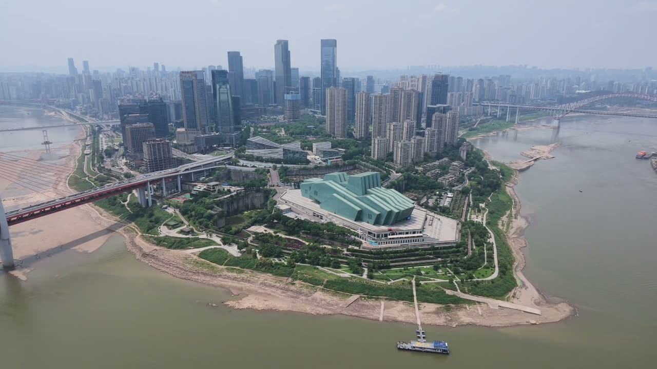
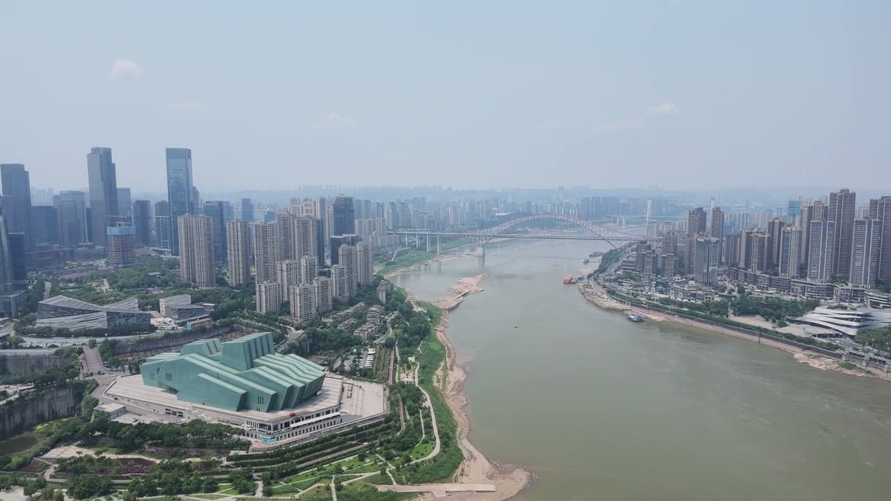
Chongqing sits where the Jialing meets the Yangtze. The peninsula between them climbs from about 168 metres at the water to just under 400 at the ridge; the municipal government gives the central urban area as 168 to 400 metres, and the peninsula’s high point, Eling, as 379.5.† That is a sixty-storey building of climb inside downtown, which is the arithmetic behind the film’s “Mountain City”. But the peninsula is only the visible part of the geography. The whole urban core sits inside a system of parallel ridges, the Chuandong ridge-and-valley country, where ridges under a thousand metres run north-north-east with valleys ten to thirty kilometres wide between them. China’s National Geographic calls Chongqing the only major city on earth built inside parallel ridges rather than beside a hill.3
Model 01 · The mountain city in section
Walk the spine山城
Drag along the peninsula
Chaotianmen · 168 m
Chaotianmen to Futuguan, 7.4 km, drawn with the vertical stretched five times. The heights are the ones the film uses: the river at 168 m, Jiefangbei around 290, Eling at 379.5, Futuguan around 340. Between the named points the line is interpolated. The floors are counted at 3.9 m each, which is the film’s own arithmetic for “sixty storeys”.
What the profile shows that the number hides is that the climb is not one slope. It is a ridge with a saddle, which is why the old city has an upper town and a lower town and why every street between them is a staircase.
Geography made it defensible; that is why it became the capital. Shanghai fell in November 1937 and the National Government proclaimed the move of the capital to Chongqing on 20 November, three weeks before Nanjing fell.† Wuhan, the interim seat, held until October 1938. What followed was one of the largest relocations of an industrial base in history: factories taken apart on the coast, loaded onto boats, and dragged upriver through the gorges under air attack. The figure the film uses, 243 factories, is the widely repeated Chinese one; no primary source we could reach settles whether it counts the city, the province or the whole rear area, so treat it as “more than two hundred”.†
Deeper — forty days at Yichang
The bottleneck was Yichang, the last port below the gorges. In the last three months of 1938, with Wuhan gone and the river about to drop for winter, the shipowner Lu Zuofu’s Minsheng company ran what Chinese accounts call the “Yichang great retreat”: machinery, arsenal equipment and tens of thousands of people moved through the gorges in about forty days on a fleet of small steamers.† Lu had founded Minsheng in 1925 from a wharf under the Hongyadong cliff, the same cliff in chapter 10. He is on the Atlas.
Then the universities came. The National Central University moved from Nanjing to Songlinpo, which is today the main campus of Chongqing University; Fudan settled at Xiaba in Beibei in March 1938; the arsenals went into tunnels, the old Hanyang works into the caves at Egongyan that are now a museum.† The population figures for those years genuinely disagree, because they count different things: the standard Chinese pair is 470,000 in 1937 and about 1.24 million in 1946, while Britannica gives a prewar base under 250,000. The film says the city went from a few hundred thousand to over a million in under a decade, and that is the safe version.†
The retreat, 1937–38. Our map: the river 2,400 km from Shanghai to Chongqing, the occupied cities, the route.
Lu Zuofu, 1937. The shipowner who ran the evacuation. Public domain, 北碚月刊.
A street in the capital, 1945. William L. Dibble, US 14th Air Force. Public domain.
轰炸
三Chapter 03 · The Mountain
The bombing
Five years of raids, the fog that grounded them, the numbers nobody agrees on, and the first line.
I heard the sirens on 5 June. They sound every year on that date, by municipal notice, to mark the afternoon in 1941 when a raid lasted long enough for the people packed into the Jiaochangkou public tunnel to run out of air.† The film says about two and a half thousand people suffocated. That is the number in most later Chinese accounts, and it is contested in both directions: contemporary Nationalist reports, written while the air-defence command was being blamed, gave a few hundred; the upper estimates run to ten thousand.11 The honest sentence is that the count has been argued over ever since.
The campaign itself ran from February 1938 to August 1943 by the Chinese count, 218 raids; English accounts that run to December 1944 give 268.11 The film says “33,000 dead”, and this is the line I most want to correct here: the commonly cited figure in the low thirty-thousands is casualties, dead and wounded together. Scholarly death tolls cluster between ten and twenty-four thousand depending on the period counted.11 Either way it was one of the longest sustained bombing campaigns of the war, and it is why the city under the city exists.
218raids, Feb 1938 – Aug 1943, Chinese count
268raids counted to Dec 1944
~32,000casualties, dead and wounded
5 Junethe sirens, every year since警
The weather was the city’s only air defence for most of that time. Chongqing’s cloud and fog season runs through the winter half-year; the raids concentrated in the clear months, which is why the campaign reads as a series of summer bombing seasons.† An earlier draft said it was foggy for half the year. No fog-day count exists in the municipal record, so the film says the mechanism and not the number.
Deeper — the fog season theatre
Here is the thing the fog did that the film never mentions. From October to May, when the cloud grounded the bombers, the wartime capital held theatre seasons: the “fog-season performances”, four of them between the autumn of 1941 and the spring of 1945, more than a hundred large-scale plays in the intervals between raids.† Chinese theatre history calls it the golden age of the spoken drama and the country’s first modern drama festival. A city organised its cultural life around the weather that kept it alive. If you want one image of what “living by the weather” meant, it is a theatre programme dated by the fog.
Something else happened during those years, and it is the hinge of the film. On 5 May 1939 the Nationalist government pulled Chongqing out of Sichuan and made it a municipality reporting straight to the centre; in September 1940 it was formally named the provisional capital.† It kept that status for fifteen years, through the war and past the revolution, until 1954, when it went back into Sichuan. The 1939 municipality was about three hundred square kilometres. That was the first line. The second one, fifty-eight years later, was drawn two hundred and seventy times larger.
The first line, 1939. Our map, animated for the film: about 300 square kilometres pulled out of Sichuan on 5 May 1939 and put under the centre.
16 June 1940. Asahi Shimbun. Public domain.
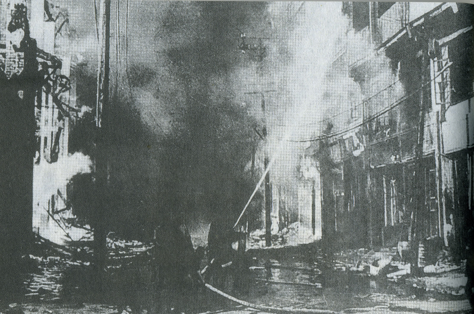
A street after a raid, 1941. 中华民国史画. Public domain.
Type 96 bombers over the city, 1942. Public domain.
界
四Chapter 04 · The Mountain
The line
How a city the size of Austria was drawn on 14 March 1997, and what the dam had to do with it.
“The largest city in the world” is true and false at the same time. Thirty-one point nine million people live inside Chongqing’s border, which is the municipal government’s own English shorthand and the resident figure at the end of 2025.† But the border encloses 82,402 square kilometres, which is Austria, and the municipality-wide urban population is 23.3 million spread across all of it. The continuous city, the nine central districts you would recognise as Chongqing, holds roughly ten million. The cyberpunk city is one small corner of a province-sized unit that happens to be called a city.
The unit was made on 14 March 1997, when the National People’s Congress approved folding two prefecture-level cities, Wanxian and Fuling, and the Qianjiang prefecture into Chongqing; the municipality was formally established on 18 June.† Forty-three districts and counties came under one government, about thirty million people, and Chongqing became the fourth of China’s directly-administered municipalities, with Beijing, Shanghai and Tianjin: its own budget, its own land, a direct line to the centre.†
Model 02 · Two lines, one scale
The boundary moved. The city didn’t.直辖
Choose a year
The 1939 municipality was about 300 km², drawn here as a circle at true scale because the recorded area was never mapped. The 1997 one is 82,402 km², the same order of size as Austria (83,879 km²). The three pieces that lit up in 1997 are the two prefecture-level cities and the prefecture that were folded in; everything else was already the pre-1997 city and its counties.
The third view is the correction the film makes with its “technically wrong”: the municipality has 31.9 million residents, but the built-up core is about ten million. Shanghai, at 6,341 km², is thirteen times smaller in area and has 24.9 million people.
Why draw it so big? The film gives the dam, and the dam is one of the reasons, not the only one. The Three Gorges reservoir reached its normal pool of 175 metres in 2010, a rise of about 110 metres at the dam that tapers to almost nothing six hundred kilometres upstream at Chaotianmen.† It submerged, in the official triplet, thirteen cities and county seats, 140 towns and 1,350 villages, and the resettlement was planned at 1.13 million people and completed at around 1.3 million, closer to 1.4 million once the later geological relocations are counted.† Most of those counties are the ones the 1997 border had just drawn in. Beijing wanted one government responsible for all of them. The other reasons in the record are the ones a state gives: developing the western interior and reforming a struggling old industrial base. Britannica’s account of 1997 does not mention the dam at all.
Deeper — what twenty years did
The film says “the next twenty years”, and the two figures it stands on are these. Between 1997 and 2017 the share of the municipality’s residents living in urban areas went from 31 per cent to 65; its operating urban rail went from zero kilometres to 264.† Neither number is building height or density. They are the reason the buildings look the way they do: a city that doubled its urban share while learning to build on a slope.
And a mechanism the film had no time for: Chongqing runs a land-quota market, the dipiao, in which rural building land returned to farming generates a tradeable ticket that lets the city grow somewhere else. It is studied internationally as one of the strangest pieces of land policy in China, and it is part of how a municipality this shape finances a city this fast.†
82,402 km²the municipality, 1997
31.9 Mresidents, end of 2025
~10 Min the continuous city
31 → 65 %urban share, 1997 → 2017
0 → 264 kmurban rail, 1997 → 2017
One small corner. The municipality and the city you would recognise, animated for the film. The corner is where the pictures are taken.A thousand drownings. Our section, Chongqing on the left, the dam on the right, vertical stretched five times. The rise is 110 m at the dam and the backwater reaches the city’s docks.Sovereign ground. Wanxian, Fuling and Qianjiang switch on, then the line to Beijing.
地
五Chapter 05 · The 8D city
The ground
A square on the 22nd floor, an escalator that counts as transit, and the block with three front doors.
At Kuixinglou you cross an ordinary paved square, reach the railing, and look twenty-one storeys straight down at a street. The local formulation is 「1楼=22楼」, floor one equals floor twenty-two.† Nobody built a square in the sky. The square is on the ground, and the ground happens to be twenty-two floors above the other ground. That is the whole city in one railing.
The Huangguan escalator, a few blocks away, is the same condition solved with a machine: 112 metres long, 52.7 metres of rise at thirty degrees, opened on 18 February 1996, two yuan a ride, and classed as public transport so a transit card works on it.† The film says “third highest in Asia”; Chinese sources call it Asia’s second-longest single-lift escalator, and I would trust neither superlative on screen. The fact I would trust is that it cost 150 million yuan, 55 per cent of it from a Hong Kong investor, with a Taiwanese practice designing and Russian machinery inside: the city’s first large public facility built with foreign money, a decade before the state paid for anything.†
Baixiangju is where the condition becomes housing. Five blocks of four to twenty-five storeys, designed between 1983 and 1987 by Zhang Congzheng, Sun Zhijing and Zeng Fanxiang of the Chongqing Institute of Architecture and Engineering, completed in 1992 as work-unit housing, on a site with a 38-metre difference in level between its bottom street and its top one.1 The tallest blocks have entrances on floors 1, 10 and 15, each onto a different named street. The film says there are no lifts. The precise version is that the lift shafts were built and never fitted out. The designers’ own phrase for what they did is 变高层为多层, turn a high-rise into a walk-up, by splitting a twenty-four-storey stack into six-to-nine-storey segments, each with its own front door on its own street.†
Model 03 · Three ground floors
Which floor is the ground floor白象居
Raise the hill, then knock on a door
Flat site. One street, one ground floor.
The stack is 24 floors at 2.8 m, drawn to the sourced figures: 38 m between the river street and the top street, entrances on floors 1, 10 and 15. Raise the hill and the second and third streets arrive at the building; knock on a door and the floor you enter on becomes floor one. Which floor is the ground floor depends only on which street you walked in from.
The mechanism view strips the building away: a flat site gives a stack one ground; a sloped site pushes a diagonal through the same stack and every plate it crosses becomes a street. Entrance floors vary by block; other blocks are recorded at roughly 1, 8 and 16.
The corridors are the part I did not expect. Because the blocks are entered from three heights, their open corridors are also shortcuts from one street to another, and people use them that way; I walked into what I thought was a noodle shop and it was somebody’s kitchen. A piece of public street runs through private homes, with courtyards and mahjong tables and laundry along it. It reads as safety and as trust, and it is also, now, a problem. A 2016 film, Chongqing Hot Pot, put the blocks on screen, and by May 2023 the building was taking thirty to forty thousand visitors a day. Residents queued to get into their own homes. On 23 May they imposed a sign-in system for visitors; on 25 May the street office made them lift it, because the corridors are legally public passages.9
Deeper — a public street through private homes, and what it costs
That two-day episode is the sharpest thing we found on the film’s “a street is public by default”. The grounds here did begin public: municipal streets, work-unit housing, corridors that anyone could walk. What the internet did was turn the arrangement into a destination, and the people who live in the arrangement have no lever to pull, because the thing that makes their home famous is the thing that makes it a thoroughfare. Chapter 6 takes this further: the multiple grounds began public and are being privatised, one viewing platform at a time.
The bridge between two blocks. Our footage, 4 June 2026. Two buildings, one corridor, and the corridor is a street.A corridor that is also a street. Our footage, 4 June 2026.The section, animated for the film. Three streets arrive; three floors glow.
基准
六Chapter 06 · The 8D city
The datum
Hong Kong left the ground and built a second one. Chongqing multiplied the first. Who owns the extra ones is the whole question.
The ground is a datum. It is where you start counting floors, and in most cities it is also the cultural anchor, the one surface everybody shares. What disorients you in Chongqing is not height or density. Hong Kong is denser and, on the numbers, four times steeper: Victoria Peak stands 552 metres above the harbour 2.67 kilometres away, a 21 per cent straight-line grade, against Eling’s 219 metres over 4.72 kilometres from Chaotianmen, 4.6 per cent.† No published source computes that ratio; it is our own derivation from the summits and it depends entirely on the method, so the method is on the drawing.
Model 04 · Two hills, one scale
Same question, different answer港渝
Toggle the cities, then what each one built
Both profiles from one origin at one scale, vertical stretched three times. Hong Kong’s hill is the steeper one by a factor of about four and a half. If extreme terrain produced the 8D city, Hong Kong would be more 8D than Chongqing. It isn’t.
The second view is the answer each city chose. Hong Kong had flat land at the bottom, much of it reclaimed, and a wall behind it, so it built a second ground: podium decks, footbridges, an 800-metre escalator climbing 135 metres, mostly as part of buildings, by whoever owned them. Chongqing never had one ground to leave; its extra grounds are terrain, and what runs across them are municipal roads.
That is the difference the film builds on: Chongqing’s extra grounds are streets, and a street is public by default. It is true and it is softer than we said it. Hong Kong’s network is a joint product of government and developers; the private footbridges link private properties and are regulated by the Buildings Department, the public ones on government land sit under Highways, and the whole thing began with Hong Kong Land’s 1965 bridge from the Mandarin Oriental to Prince’s Building, replicated because it was profitable.† The government maintains 731 public footbridges as of May 2025; the private ones are not in any count, which is why every total you read is different.† Chongqing, by contrast, built seventeen mountain-city trails totalling about 353 kilometres between 2019 and 2022, and can tell you the number because it built them.†
But Hongyadong is a privately owned complex whose “streets” are commercial circulation. Baixiangju’s shortcuts run through residential property. Raffles City closed a public street.12 The honest version, and the better line, is that Chongqing’s multiple grounds began public and are being progressively privatised, which is the same arc as the neon and the same arc as the cliff of lanterns. And there is a serious objection to the premise itself: Karl Kullmann argues Hong Kong is not groundless at all, that its 60,000 registered engineered slopes are the real ground infrastructure and the skyways keep returning you to earth.8 I think he is half right, and the half he is right about is why this chapter is about ownership rather than altitude.
Deeper — three dates, not one
The film says the city builds the roads first, then auctions the plots between them, and that the system only goes back to the nineties. Three different things carry three different dates. The leasehold land market is 1988 to 1990. Compulsory competitive auction of land arrived in 2002 and was enforced from the “8·31” deadline of 2004; through the nineties most land went by negotiated agreement. And government-serviced “roads first” plots are a norm of 2007 to 2018.†
Which produces a chronology problem the booklet has to own. Baixiangju was designed in 1983 and the escalator built in 1992 to 1996; most of the peninsula’s multi-level fabric predates the auction system entirely and was made by work units and the municipality under the planned economy. The auction mechanism explains the new districts, Liangjiang and Yubei, not the old city. The film is right about how new Chongqing meets its roads and wrong, by implication, about how the famous buildings got their doors.
21 %Hong Kong, harbour to Peak
4.6 %Chongqing, river to Eling
731public footbridges, HK, May 2025
353 kmmountain-city trails, 17 routes步道
The second ground, animated for the film. Hong Kong's answer to a wall of rock: leave the street and build another one, deck by deck, each piece owned by whoever built it.One of the 353 kilometres. A mountain-city trail, 5 June 2026. Municipal, public, and steeper than anything in Central. Nobody owns the stair.
梯
七Chapter 07 · The 8D city
The steps
Six hundred years of climbing, the porters who carried the city up, and the six ways a house meets a slope.
Shibati means “eighteen steps”. It was the spine between the two halves of the old town: the docks down at the water, the lower city, and the town up on the ridge, the upper city, and they are still called that, 下半城 and 上半城. The peninsula was walled in stone in 1371, the fourth year of the Hongwu reign, by Dai Ding, with seventeen gates, nine open and eight sealed.6 The film says that for 650 years the only way between the two halves was to climb. The gazetteer’s own claim is gentler and truer: the staircase was the principal passage. By the twentieth century there were roads, then a cable car, then lifts.
Climbing was an industry. The porters with a bamboo pole and two lengths of rope, the bang bang, are Chongqing’s own word for the labour the terrain demands; at the peak in the 1980s there were reckoned to be around four hundred thousand of them, and they carried most of what moved through the city. A 2022 university survey found fewer than two thousand left, most of them old; by 2025 the active porters at Chaotianmen were counted in the hundreds to a thousand, nine in ten over sixty.† The stairs outlasted the people who made them work.
Model 05 · Cut, hang, hold, step
How a house meets a slope吊脚楼
Choose a move
The municipal gazetteer lists six techniques: 筑台, 悬挑, 吊脚, 拖厢, 梭厢, 爬山. Orange is the surface you stand on; that is the one rule of the drawing. The film shows three of the main ones. We have drawn a fourth, the cantilever, because it only makes sense next to the hung wing: one has posts down to the ground, the other has nothing under it.
Two are deliberately not drawn. 拖厢 and 梭厢 both contain the character for the side wing and are almost certainly ways of attaching it, but no source we could reach defines them well enough to draw, and drawing them from the characters would be inventing them.
The gazetteer’s definition of the hung wing is almost word for word what the film says, with one correction: the main house sits on solid ground, 实地, not solid rock.6 Build like that for a few hundred years and the front door stops being a fixed thing; it follows the hill. Baixiangju is that tradition poured in concrete, and the cliff of lanterns in chapter 10 is that tradition rebuilt without the timber that defined it.
Deeper — the vote on the Eighteen Steps
Shibati as it stands is a rebuild. In June 2010, as part of Yuzhong district’s old-city demolition, more than seven thousand households were asked, in Chongqing’s first public vote on a demolition, whether they wanted their housing renovated; 96.1 per cent voted to relocate.† That is not a regime bulldozing a neighbourhood; that is people voting to leave houses without plumbing. The critique that followed the reopening is specific rather than nostalgic: no in-place renovation was ever offered, national chains replaced local trades, most of the old banyan trees went, and the attractions came from other cities.† The uncomfortable sentence, which the film’s ending has to be able to say, is that a place is often most precious to the people who never had to carry water up it.
The walled peninsula, Guangxu era. 重庆府治全图, Harvard University. Public domain. Seventeen gates, nine open.The bang bang, in bronze. A porter cast at the foot of the old town's stairs, 5 June 2026. Four hundred thousand of them at the peak; a few hundred left.Three ways up, animated for the film. Same drawing, one move per slope.
站
八Chapter 08 · The 8D city
The station
Two plans wanted one plot. Nobody moved. The 20 centimetres that keep the train off the flats.
Everyone at Liziba is there for one shot, and the city built a viewing platform so that they could get it. The train enters the side of a nineteen-storey building on the eighth floor and comes out the other side. It looks like a stunt. It is a very tidy structural problem: a train vibrates and brakes, a building wants to stand still, so the station sits on six independent piles about 22 metres long, on air springs, with a clearance of 20 centimetres between the building’s inner wall and the station structure. The two systems never touch. The structural engineer who led the design, Ye Tianyi of Chongqing University, put it plainly: you could knock the flats down tomorrow and the trains would keep running.4
Model 06 · Two plans, one plot
Living above transit李子坝
Scrub the build, or press play
Two plans on one plot
Every measured number on this drawing has a source, and the indicative ones are labelled. Nineteen floors above ground; shops on 1 to 5; the concourse on 6, equipment on 7, the platform on 8 at 26 metres above floor 1; eleven floors of flats from 9 to 19 on a transfer beam; six piles about 22 metres long; 20 centimetres clear. Storey heights above floor 9 are drawn at 3 metres and are not sourced.
The first frame is the reason it exists. Two plans wanted the same plot: a developer’s residential tower, and a monorail station box at floors 6 to 8, on a strip with a cliff behind and the Jialing in front. Rerouting the line or moving the tower both cost more than sharing. So they built both.
The design began in May 1998 with a thirteen-person team; it went through at least six major revisions over two years, solving three problems in turn, the incompatible structures, the geology and the fire code, and the station was completed in March 2004, in trial use that year and in full service by 2006.4 Ye’s word for the result was 将就, jiangjiu: making do, a compromise you can live with. The film says the developer held the parcel on a forty-to-fifty-year lease for a mixed-use block. Chinese land-use rights run seventy years for residential, forty for commercial and fifty for mixed; if the plan was a plain residential tower, the term was seventy. We have flagged the line to the film team.
The reason it was worth making do is money, and the money was policy. In late 1999 the state launched the programme to develop the western interior, Go West; the foundational notice is dated 26 October 2000 and it opened the tap: tax breaks, directed credit from the state banks, transfers straight from the centre.† The film says the monorail was named one of ten key projects, and for a month we could not source it. Then we found the press briefing of 18 May 2000, preserved on the planning commission’s own site, which lists the ten projects newly starting that year; item four under transport is Chongqing’s elevated light rail, Jiaochangkou to Xinshancun, phase one.7 When the line reached this parcel and found a building in the way, going through was the cheapest and fastest answer, and fast was the point.
Deeper — the records, checked
The cold open of an earlier cut said Chongqing had the world’s highest metro station and its deepest. Neither survives. By elevation Quito’s metro sits around 2,800 metres; by depth the record is Arsenalna in Kyiv at about 105 metres, and Chongqing’s Hongtudi, at a commonly given 94.5 metres, is China’s deepest, not the world’s.† The monorail claim is the one that nearly held: two lines, about 98 kilometres, the longest monorail system in daily passenger service anywhere, and Line 3 alone the longest single monorail line ever built. Cairo’s two lines total 101.5 kilometres as of March 2026, but one has no commercial-service date and the other is still under construction.†
And “8D” itself: not a brand, not an official. A netizen’s comment in the spring of 2017, converging with the opening of the Huangjuewan interchange, five levels, fifteen ramps then and twenty now, eight directions, and with a March 2017 video of this station that reached the British tabloids.† The meme is a year older than the Douyin wave that made the city famous.
The platform the city built. Our footage, 3 June 2026: two hundred phones waiting for the same eight seconds.The section, animated for the film. Plan A and plan B, then the box on its piles.Nowhere left to go. The real site read in three colours: the hill, the river, the line.
霓虹
九Chapter 09 · The layers
The neon
One corner, lit for the vertical frame, and a municipal plan called Sleepless Chongqing.
I came expecting blocks of it. It is one corner. The Deyi World block is a shopping centre, and the neon that made it one of the most photographed surfaces in China went up as an upgrade that began around 2020, facade, lighting, interior and tenant mix together, for marketing.† It is composed for a phone held upright. Step back and the frame ends; the building next door is a building.
The same year, in July 2020, ten municipal departments jointly issued a plan for the night economy under the name Sleepless Chongqing: a “1+10+N” framework, thirty-three municipal-level night-market streets and a first batch of thirteen demonstration districts.† By 2022 the city reported four night-market festivals, more than 73 billion yuan in sales and night consumption at 60 per cent of the total. The neon is not an accident of a thousand shopkeepers. It is line 1 of a policy, and the policy is working.
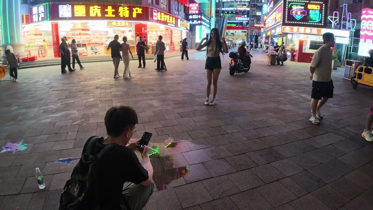
Designed for the vertical. Our frame, held the way the facade wants to be held.The corner, and the people photographing it. 5 June 2026.
If you saw our Hong Kong film you know the other half of this. There, the neon happened organically, out of hundreds of shopkeepers competing for attention on cramped streets, hand-bent over open flames; that accidental commercial logic became the visual signature of Ghost in the Shell, Blade Runner, the genre. And Hong Kong is taking its signs down. Chongqing put new ones up, in one place, to be photographed, and it is a strange thing to feel nostalgia for a copy while standing in front of it.
机位 · the shot
What it is, and the instruction people follow
千厮门大桥
The Hongyadong money shot. Taken from the bridge deck, not from the complex.
白象居 3号楼连廊
Baixiangju block 3’s sky corridor, framing the Yangtze cableway crossing behind it.
李子坝观景台
The official Liziba platform, plus the “walk 200 m toward exit A” variant that gets rail and river in one frame.
鹅岭二厂天台
The rooftop peninsula panorama, shot at dusk.
南山一棵树
The classic wide from across the river. Ticket, 30 yuan.
解放碑仰拍
The Liberation Monument from directly below, the WFC tower as backdrop.
琵琶山正街彩色步梯
The painted stair, shot from the building opposite. “Stand mid-stair for the best effect.”
弹子石老街
Frames Chaotianmen, the opera house and Raffles City together.
The eight camera positions reproduced across accounts, from a Chinese photo-route guide. The film’s cold open says the same angles keep appearing; this is the list.
Deeper — how the feed was made, in four dates
The cynical read is that it was always marketing. The record is more interesting. Spring 2017: a netizen calls Chongqing the only 8D city, the Huangjuewan interchange opens, and the Liziba video goes round the world. 2018: a Douyin and Tsinghua study finds Chongqing videos past a hundred million plays and states that over 80 per cent of the top city-image creators were personal accounts, that recommending the city was spontaneous.† From May 2019: the government’s management measures follow the wave rather than start it. 10 April 2024: Xiaohongshu launches its “city calling card” plan, which gives signatory cities content tools, tuned search and recommendation, quarterly reports and allocated exposure, and Chongqing is a named strategic-cooperation signatory.†
Organic meme, viral wave, institutionalised, algorithmically contracted. And now the state posts the influencer shot: a foreign-ministry spokesperson put Liziba on overseas social media in June 2024 and Kuixinglou in April 2025, “its floor 1 is also floor 22!”† The tourist’s picture and the soft-power picture are the same picture.
复刻
十Chapter 10 · The layers
The replica
Paper wharf, salt wharf, stilt houses, a road through them, and the cliff rebuilt for the camera.
Hongyadong looks like it is from Spirited Away, and it is twenty years old. The lane under the cliff was called 纸盐河巷 for its two wharves, the paper wharf and the salt wharf; Hongyamen, one of the seventeen Ming gates, stood above it until the road-widening of the 1920s and 30s took it down, after which stilt houses filled the slope, and it was on that lane, in 1925, that Lu Zuofu founded the shipping company that would run the wartime evacuation.† The houses were 吊脚楼, the hung-wing type from chapter 7, built in timber down a cliff above a working wharf.
The shipments stopped, the houses decayed, and in 1993 they were cleared to build the riverside road. Only one source in the record supports that date, the civil-affairs bureau’s page on old place names, so we cite that one.† Then a developer, He Yongzhi, won a 2001 bid against eleven companies to rebuild the cliff; it was built between 2003 and 2006 and opened in September 2006, on a budget that started at 90 million yuan and finished at 385 million.5 The film says it was bought in 2006. It opened in 2006. We have flagged that too.
Deeper — a diaojiaolou without wood
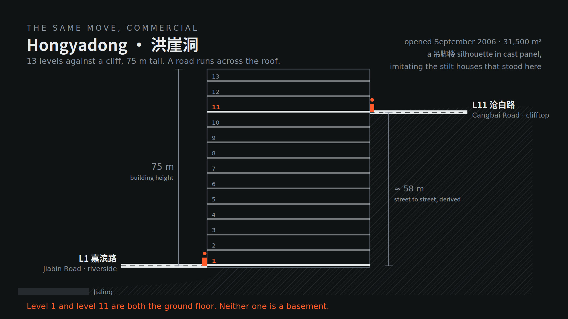
The developer wanted to build stilt houses and could not use their defining material. Experts warned that heavy timber would not survive Chongqing’s acid rain, and she put the dilemma herself in an interview: “I wanted to build diaojiaolou, but absolutely could not use its most important material, wood. And a diaojiaolou without wood, is it still a diaojiaolou?”† The scheme went through three designs, partly for that and partly because it had to give up 42 metres of its site to the new bridge. What stands is a concrete section 75 metres tall on a strip about 30 metres wide, eleven or thirteen levels depending on how you count the cliff terraces, with a road across its roof: level one meets the river road, the top meets the clifftop road.5 No architect of record is publicly identified anywhere. The developer is called the designer in the Chinese press because she drove the concept, and that absence is itself the finding.
You could say commercialisation saved the history. The old name is back on the street signs, and on a busy day the complex takes around a hundred thousand visitors, most of whom had never heard of the paper wharf.5 The peer-reviewed reading is colder: the rebuild relocated the manual labourers who lived there and piles the vernacular up vertically to make a poor neighbourhood spectacular for people with more money.1 Both are true. That is what makes it the film’s fourth picture and not its third.
Plate · Rock and air
The same house, multiplied down a cliff洪崖洞
From the film’s drawings
The hung wing, recalled and then copied four times down the cliff. This is the typology that the 1945 and 1980s archive photographs show above the paper-and-salt lane; the 2006 rebuild follows the section and keeps the roofline, in concrete, at three times the height.
Thirteen levels and 75 metres from the river road to the clifftop road, per the municipal gazetteer; the street-to-street figure of about 58 metres is derived and is marked as such on our drawing.
The same move, commercially. A road across the roof: our section.
The cliff before the myth, 1926–28. The Jialing bank from the north. Public domain.
像
十一Chapter 11 · The verdict
The picture
Is it a cyberpunk city? Yes, and not because of the neon. Baudrillard’s four phases, applied to one of our own frames.
Cyberpunk is not a lighting scheme. It is a world in which everything, your history, your language, your culture, has been turned into something to sell. On that definition Chongqing qualifies, and not because of the corner with the Spider-Man. It qualifies because of the tunnels that are restaurants, the housing block that is a destination, the cliff that is a shopping mall with the old street name reinstated, and the viewing platform the city built so that a compromise could be photographed properly.
Baudrillard laid out four successive phases of the image in the essay that opens Simulacra and Simulation: it is the reflection of a profound reality; it masks and denatures that reality; it masks the absence of a profound reality; it has no relation to any reality whatever, it is its own pure simulacrum.10 I learned that in architecture school and it never landed until I stood at Liziba with two hundred people holding their phones up at a train. You take a picture of a place. People come to see the picture. So the place starts building itself to look more like the picture. Until the picture is the only thing people come for.
Model 07 · Four phases of one picture
The copy wins拟像
Step through the phases
One frame, ours, shot at the Deyi corner on 5 June 2026. Phase one is the frame as we shot it. Phase two grades and stretches it the way the feed does. Phase three crops to the tight vertical everyone posts, and the ordinary street outside the crop fades, because the crop is hiding that the endless neon city it implies is not there. Phase four multiplies the crop until the copies refer only to each other.
This is an editorial analogy, not a proof that the street is unreal. The street is entirely real. What is absent outside the frame is the promised world, not the physical corner.
It is working. Inbound tourist visits to Chongqing rose 183.6 per cent in 2024 over 2023, which is the “almost tripled in a year” of the film, from a calculated baseline of about 450,000 to 1.28 million; 2025 added another 68 per cent, to 2.15 million.† I am in that number. I came for the picture and got to see much more of a country I had filed, a few years ago, as a surveillance dystopia. The camera count that made that phrase stick was a per-capita guess, and the city has since dropped out of the ranking that produced it.†
+183.6 %inbound visits, 2024 vs 2023
2.15 Minbound visits, 2025
4phases of the image, Baudrillard 1981像
1984“consensual hallucination”, Gibson
The skyline as a screen. Jiangbeizui from the Hongyadong side, 4 June 2026. Every facade is one display, and the display is the city's name.The whole thing, lit. The peninsula from the hotel window, 6 June 2026, through the glass. The picture people come for is made of a million small lights that were not put there for it.
William Gibson, who gave the genre its name, called cyberspace a consensual hallucination: millions of people agreeing on something that is not there. Chongqing is the version of that you can stand in. Four pictures, and counting. Every person who comes here makes another one, including me, and including you, in about ten seconds, when you decide what this page was about.
The real Chongqing is somewhere underneath all of these pictures. I don’t think you get to it by looking harder. I think you just get to make a better picture.
The ending we chose, of the three drafted
Drawings and models · every one lives in its chapter
The sources that changed what the film said, each with a note on why. Everything else we read, about fifty more items, is in the Complete Research Trail below.
Yi Jin · Urban Planning 7(4), 2022, pp. 364–376 · CC BY
This is the paper that contains the film’s thesis in one citable sentence: residents enter Baixiangju “by the entrance at ground level by the riverbank, through a gate on the 10th floor halfway up the slope, or by an entrance on the 15th floor leading from the main road at the top.” It is also where the colder reading of Hongyadong comes from, the one that says the rebuild relocated the labourers and stacked the vernacular up to make a poor neighbourhood spectacular for people with money. It covers the mountain-city trails too. Peer-reviewed, free, nine photographs and a terrain map, no drawings. If you read one thing, read this.
The most serious English piece on exactly this subject, and the one that ties the “8D city” talk to what land liberalisation did after the planned economy.
More
Roast covers Liziba, Baixiangju’s “multiple vertical exits”, Raffles City and the moment around 2016 when the discourse started. He is the English-language Chongqing urbanist; the Weibo criticism of Raffles on the board comes through him.
星球研究所 (Institute for Planets), 2023 · excerpt on Tencent News
China’s most respected geography-visual publisher, arriving at almost exactly our conclusion: the so-called spectacle is people adapting to mountain and water with a few centuries of practice.
More
Treats the stilt houses, the stairs, the cable cars, the lifts and the porters as one continuous adaptation system, which is the architecture of chapter 7. Their axonometric terrain diagrams are the reference I most envied.
澎湃 The Paper, 2018 · the design lead’s own account
The structural engineer, on the record: cost was the motive, the floor order is 6 concourse, 7 equipment, 8 platform, and the word for the result is 将就.
More
Everything reachable on Liziba is journalism quoting this man; no engineering paper or drawing set has been published. Our section is built from this interview and its companion piece on the six piles and the air springs. He is a structural engineer, not an architect, and we say so.
The cleanest timeline of the cliff: the 2001 bid against eleven companies, the build from 2003 to 2006, the budget that went from 90 to 385 million yuan, and the 42 metres given up to the bridge.
More
It also has the number that matters for chapter 10: a 79-metre height difference on a strip about 30 metres wide, with roads across the rooftops. The developer’s own words on timber and acid rain are in the companion interview in The Paper, in the trail.
The primary source for the six techniques and for the definition of the hung wing, almost word for word what the film says, minus the rock.
More
「筑台、悬挑、吊脚、拖厢、梭厢、爬山」: six, not three, which is why the film says “three of the main methods” and why two of them are deliberately not drawn in Model 05. The same office confirms the 1371 wall, Dai Ding, and the seventeen gates.
State Development Planning Commission, via the NDRC archive · primary document
For a month “one of ten key projects” was an unverified line in the script. This document lists the ten projects newly starting in 2000; item four under transport is Chongqing’s elevated light rail, phase one.
More
The companion instrument is the State Council notice of 26 October 2000 that opened the tap. What could not be verified is the tourism line the film once quoted: it exists, but in the 2020 restatement of the policy, two decades after the decision. We cut it.
The best argument against our own premise. He says Hong Kong is not groundless at all; the 60,000 engineered slopes are the ground, and the skyways keep putting you back on it.
More
Read it before you read chapter 6, because the chapter is written to survive it. It moved the comparison off altitude and onto ownership, which is where it should have been all along.
Thirty to forty thousand visitors a day, residents queueing to enter their own homes, a sign-in system imposed on 23 May and lifted on the 25th because the corridors are public.
More
This is the two-day story that turned “a street is public by default” from the film’s strongest line into its most complicated one. It is the sharpest available illustration of a public arrangement colliding with the picture of itself.
Jean Baudrillard, 1981 · Sheila Faria Glaser translation, University of Michigan Press, 1994 · the four phases are on page 6
The essay that opens it, “The Precession of Simulacra”, is the one the film paraphrases. I read it at school and did not understand it until I stood at a viewing platform.
More
Two cautions we hold ourselves to: the four phases are phases of the image, not a ladder every city climbs, and they are different from his separate account of the orders of simulacra. Model 07 is an analogy built on one of our own frames, not a proof.
Tetsuo Maeda · in Bombing Civilians: A Twentieth-Century History, 2010
The scholarly anchor for chapter 3, and the reason the booklet says “casualties” where the film says “dead”. Death tolls cluster between ten and twenty-four thousand depending on what you count.
More
Also where the two raid counts come from: 218 to August 1943 by the Chinese reckoning, 268 to December 1944 in English accounts. Neither is wrong. They answer different questions.
Frank Capra, US Army · public domain · Internet Archive, 63 min
The best free footage of the wartime capital that exists: the city being bombed, the shelters, the new capital at Chungking, three of our beats in one reel.
More
It is propaganda, and it says so on the tin. Watch it for the shots of the stairs and the river; treat the narration the way we treat a script that hasn’t been fact-checked.
Want every source? The Complete Research Trail is the full list, about sixty items: the municipal record for every number in the film, the fact-check with verdicts, the sourcing map, the papers, and the notes on what we cut. Claims on this page marked † rest on it. It is being packaged as a PDF.