ONE · THE QUESTION

We have been searching for Atlantis for two thousand years
using a drawing
that left out half the city.

Atlantis is the most famous lost city in the world. The shape we know — three perfect concentric rings — is a 1929 illustration drawn for a Greek textbook. It came with a second drawing nobody reproduces: an agricultural plain the size of Spain, wrapped by a second canal Plato describes in detail.

The mythThe blueprintThe logo
SCROLL ↓
The Question

Atlantis was never a place. It was a description so beautiful that two and a half millennia of readers tried to find it on a map.

Plato wrote it down in 360 BC, inside two unfinished dialogues, as a morality tale about a civilisation that grew rich, grew arrogant, and was sunk by the gods. Almost everything else we think we know about Atlantis was added later, by people who had run out of patience for the tale being a tale. The Renaissance turned it into a blueprint. The seventeenth century gave it coordinates. The nineteenth turned it into history. The twentieth turned it into a racial theory. The twenty-first turned it into a viral image.

Every age met Atlantis with the tool it had in its hand. The shape we inherit — three perfect concentric rings, the icon you see on YouTube thumbnails and AI reconstructions and conspiracy threads — is the shape that survived being passed through all of them. It is not what Plato wrote. It is the part of Plato that was small enough to fit on a page.

In 1929, a British classicist named R.G. Bury published the Loeb Classical Library translation of Critias and drew two diagrams to accompany the text. The first showed three concentric rings — the inner city. The second zoomed out to a 2,000-by-3,000-stade agricultural plain surrounded by mountains, intersected by a grid of irrigation trenches, wrapped by a second canal Plato describes at length. The first drawing went on to become Atlantis. The second drawing almost completely disappeared.

A circle is not a city. It is something more powerful — a logo. And a logo only works if it is the thing.

Three shapes sit at the centre of the story this booklet tracks — the myth Plato wrote, the blueprint the Renaissance tried to build, and the logo the modern internet refuses to let go of. Each is a different age's answer to the same uncomfortable question: what do you do with a description so seductive that nobody wants to look at the rest of it?

Worldbuilder's Frame · Focused System

Most cities you read about are described from the ground up — the gate, the marketplace, the grid, the day's walk to farmland. Atlantis is described from the sky down. It was an emblem first and a city second. This video is about what happens when a civilisation lives inside a description that was always more logo than blueprint — and what every age did with the rings, on its way to making the icon you already know.

Two · The Visual Atlas

Everything we pinned to the wall while making this.

A research wall. Every reference, precedent, sketch, and tangent the script draws on — including the threads that did not survive the cut.

Research paper
Plato, Critias & Timaeus
The source. Two unfinished dialogues, 360 BC. Everything afterwards is people arguing with these two texts.
Diagram · 1929
“Plan of the Inner City” — R.G. Bury
This is the drawing that became Atlantis. Three rings, one little island. If you've seen Atlantis on a thumbnail, you've seen this.
Diagram · 1929
“Plan of the City” — R.G. Bury
The drawing nobody reproduces. The 2000-by-3000-stade plain, the grid of trenches, the second canal. We almost made the whole video about this single image.
Case study · c.1460
Sforzinda — Filarete
The first city designed from scratch in the Renaissance. A perfect star drawn for the Sforza family — radial streets, concentric rings. Plato's geometry, off the page.
Primary source · 1482
The first résumé — Leonardo da Vinci
A polymath selling himself to the Sforzas as someone who could design an entire civilisation. By the time Leonardo wrote this letter, Filarete had already spent two decades as their architect — and had drawn them a perfect-geometry city.
Case study · 1593
Palmanova
A nine-pointed star you can still walk through today. Built as a perfect-geometry fortress between three empires. Nobody wanted to live there. The Republic eventually had to pardon criminals just to fill it.
Primary source · 1665
Kircher's map of Atlantis
The first time anyone drew Atlantis with coordinates. A Jesuit polymath trying to prove the Greeks, the Egyptians, and the Bible all described the same flood.
Research paper · 1882
Atlantis: The Antediluvian World — Ignatius Donnelly
A US congressman wrote a bestseller arguing every culture, every myth, every language descended from one drowned island. The book that made Atlantis “history.”
Case study
Helena Blavatsky & Theosophy
A Russian occultist who turned Donnelly into a religion. The Atlanteans became “root races” we descended from. The pseudoscience starts looking like science here, and that's exactly the problem.
Primary source
Scott-Elliot's psychic maps
A Theosophist drew detailed Atlantean maps using “psychic powers.” They look like geology textbooks. Cut for length, but they're the receipt for how thin the line between science and séance got in the late 1800s.
Research paper
Heinrich Himmler & the Ahnenerbe
When the rings became state policy. The SS funded real expeditions to find proof the “Aryan race” descended from Atlantis. This is the end-state of taking a logo seriously.
Pop culture · viral
The Richat Structure
A geological dome in the Sahara that went viral as “the real Atlantis” because it has rings. It's 400m above sea level, that region hasn't been underwater for 99 million years, and there are no artefacts. The rings did all the work.
Case study
Pavlopetri — Greece
A 5,000-year-old Bronze Age port, intact, four metres underwater off southern Greece. Streets you can still trace. Building foundations. Amphora on the seabed. Tiny graves, probably for babies. Nobody knew it was there until the 1960s.
Case study
Thonis-Heracleion — Egypt
Egypt's gateway to the Mediterranean. A massive trade hub that sank into the Nile Delta. Wasn't found until 2000. They're still pulling giant statues out of the mud.
Case study
Doggerland — North Sea
An entire continent connecting Britain to mainland Europe. Forests, rivers, communities — people lived there for thousands of years. Sea levels rose; coastline crept in; eventually it was gone. Cut from the video, but this is the real lost world. Fishing trawlers in the North Sea still pull mammoth bones and stone tools off the seabed.
Research paper
The Storegga Slide — c.6200 BC
A massive underwater landslide off the coast of Norway that triggered a tsunami that may have wiped out a quarter of Britain's coastal population. In a single event. Cut for length, but if Plato was remixing inherited memories of catastrophe, the shape of this is in the warning.
Case study
Akrotiri & the Minoan collapse
The most mainstream academic Atlantis candidate for a long time. Bronze-Age Akrotiri on Thera had hot and cold running water piped through the walls — before Rome, before Athens. Then around 1600 BC, the volcano erupted, the city was buried in ash, and an advanced island culture was destroyed by nature overnight. The dimensions don't match Plato. The pattern does.
Research paper
Spartel Island — Strait of Gibraltar
A submerged island just inside the Pillars of Hercules, in roughly the right direction Plato pointed. Bathymetric scans show it sat above water in Plato's millennium and went under afterwards. Cut for pacing, but it's the candidate that comes closest to the geography Plato actually wrote.
Pop culture · viral
The Yonaguni “Monument” — Japan
A diver finds steps and right-angled walls off the coast of Japan and is sure he's looking at a sunken city. The geologists arrive later: it's natural sandstone fracturing along the bedding planes. Cut, but I keep thinking about how the divers still believe even after the science. The wanting outlasts the evidence.
Pop culture · viral
Zakynthos “columns” — Greece
Underwater “columns” off Zakynthos that everybody pointed at as proof of an ancient submerged port. Turned out to be five-million-year-old volcanic concretions formed around methane vents. Same shape as the Yonaguni story. Same ending.
Sketch · 1933
Géza Maróti's Atlantis manuscript
A Hungarian architect spent decades on a cultural history of Atlantis. The manuscript was finished in 1933 and is still unpublished. Cut for length, but the fact that an architect — an architect — couldn't let go of this either is part of the answer to why the rings persist.
Research paper · 2018
“Belief in Atlantis: 40% → 57%”
Chapman University's annual Survey of American Fears found the number of Americans who believe Atlantis was a real place jumped from 40% to 57% between 2016 and 2018. That's not a fringe belief any more. That's mainstream. Cut, but the chart was the moment I realised this video had to exist.
Online discourse
Plato's Theory of Forms
The argument we cut, but couldn't stop thinking about: maybe Atlantis is the Theory of Forms in city shape. A perfect idea designed to break the moment you build it. That's why it sinks.
Research paper
Ecbatana — Herodotus
A century before Plato, Herodotus described the Median capital as concentric walls, each painted a different colour, the innermost gilt in gold. Plato almost certainly read it. He wasn't inventing — he was borrowing.
Three · The Chapters

Two and a half millennia of arguments, told in seven chapters.

The chapters that follow walk the video's spine. Each one is an age picking Atlantis up off the page and doing something to it — a shape, a coordinate, a theory, a religion, a search. The first three are about how the description became a city. The middle three are about how the city became a logo. The last is about what the logo cropped out.

Read it as one continuous argument: every era inherits the rings, and every era leaves them slightly more abstract for the next one to find.

Chapter I · 360 BC

Plato

The morality tale he never finished.

Chapter I · the source

Atlantis enters the world inside two unfinished dialogues, written by Plato around 360 BC. It is not a record. It is a story Plato uses to make a point.

He places the city past the Pillars of Hercules — beyond Gibraltar, in the Atlantic — on an island so resource-rich it grows arrogant, declares war on Athens, loses, and is sunk by the gods. The lesson is clean: hubris drowns. Most classicists read it as a morality tale, the same way they read every other myth Plato uses to dress an argument.

Three things about the writing, though, do not behave like a myth. Plato presents the story through a chain of real people — an Egyptian priest tells it to Solon, who tells his grandson, who tells Critias, who tells Socrates. He gives it dimensions: a central island five stades across, three concentric rings of land and water, a canal three hundred feet wide, walls clad in brass and tin, hot and cold springs, an alloy called orichalcum. And then, having set up something that reads almost like a brief, he stops writing. The dialogue breaks off mid-sentence. We don't know why.

What's left is a half-finished description of a place whose only function in the original text is to lose a war. Plato's other ideal city — the one in the Republic — has zero dimensions. Atlantis has them by the page. That asymmetry is the seed of every reading that followed.

The thing nobody ever quotes: he never finishes it. Two thousand years of people convinced this was a real place, and the original document is incomplete.
Chapter II · 1400–1600

The Ideal City

What happens when Plato's geometry lands in the hands of architects with private clients.

Chapter II · the blueprint

Plato disappears for a thousand years. Around 1400, Europe rediscovers him along with the rest of the classical canon, and architecture has to be reinvented to fit the new texts.

Before this, an architect was effectively a high-craft mason — apprenticeship, guild, lifetime of Church commissions. After this, in cities like Florence, Milan, and Urbino, powerful families compete with each other not just by army but by culture. Suddenly there are private clients with big ambitions and bigger budgets, and books from antiquity full of perfect forms and sacred geometry. Something changes.

In 1482 Leonardo da Vinci writes a job application to Ludovico Sforza of Milan that reads like a polymath's pitch — bridges, war machines, sculpture, painting, “buildings public and private.” It is widely considered the first résumé. He didn't get the architect's role. The Sforzas had already had their court architect for a generation: a man called Filarete, who a few years earlier had drawn them a city from scratch and called it Sforzinda. A perfect star. Radial streets. Concentric rings. The Renaissance answer to the question “what does a city look like if you start from Plato?” Sound familiar.

What spreads from there is a century-long conviction that geometry itself can produce virtue — that the right plan generates the right citizen. Architects across Italy keep drawing these stars and circles, and they call it the Ideal City. A few of them get built.

Fig. 01
Fig. 01 · Palmanova, 1593

The first time anyone tried to live inside the geometry

Palmanova was built as a military garrison on the Venetian Republic's eastern frontier — a nine-pointed star with a central piazza and radial streets, designed to give defenders overlapping fields of fire. The geometry worked beautifully on paper.

Nobody wanted to live there. There were no ports, no trade routes, no economic reason for the place to exist. At street level, every direction looked the same. The architects had believed the geometry alone would draw people in. The Republic ended up issuing pardons to criminals and handing out free land just to populate it. The first residents of the Ideal City were prisoners.

Chapter III · 1665

Mapping the Myth

The first time anyone gives Atlantis coordinates.

Chapter III · the coordinates

Up to here, Atlantis is still an idea. Nobody's looking for it. Then the seventeenth century shows up with ships, instruments, and a compulsion to catalogue everything.

Athanasius Kircher is a Jesuit polymath of the era — a Leonardo-shaped figure whose curiosity ran from volcanoes to Egyptian hieroglyphics to Chinese languages, and who at one point had himself lowered into the crater of Vesuvius to study it. All of his cataloguing pointed in one direction: he was trying to prove that the Greeks, the Egyptians, and the Bible were all describing the same Flood.

Plato's Atlantis story comes via an Egyptian priest. For Kircher, that was almost too clean. In 1665 he published a map placing Atlantis squarely in the middle of the Atlantic, between Spain and the Americas, with coordinates and a small circle on the island where the city sat. This is the first time anyone treats Plato's description as geography. Once a thing has a position, people can search for it. From this map onward, somebody always is.

Chapter IV · 1882

From Geography to Pseudoscience

The book that made Atlantis the origin of every civilisation.

Chapter IV · the theory

Two centuries after Kircher gives Atlantis a location, an American congressman gives it a universal theory.

Ignatius Donnelly publishes Atlantis: The Antediluvian World in 1882. The argument is ambitious: Atlantis was the source civilisation. Every culture, every myth, every language — Mesoamerican pyramids, Egyptian pyramids, the Greek pantheon, the Norse gods, biblical Genesis — all of it traceable to one drowned island. He fills the book with side-by-side diagrams: a Mesoamerican stepped temple next to a Mesopotamian ziggurat next to a Sumerian flood story next to a Hebrew one. The patterns are real. The conclusion is not.

The book is a runaway bestseller, partly because of timing. Schliemann had just unearthed Troy a decade earlier — a place everyone had treated as fiction, suddenly under a shovel. Darwin had published On the Origin of Species thirty years before that. The world had been told that “myth” could be true and that humans were apes inside the same generation. Donnelly's book reads like a third instalment of that disorientation. And it looks like science. Same diagrams, same comparisons, same cold typography. That's exactly why people believed it.

There was a confidence in the air — that if you looked hard enough, you could find anything.
Chapter V · 1880s–1930s

From Pseudoscience to Race

Where the rings stop being innocent.

Chapter V · the religion · the policy

Donnelly's book reaches a Russian occultist called Helena Blavatsky, who unfolds it into a religion. Theosophy teaches that humans did not descend from apes, but from a series of “root races” — and the Atlanteans were one of them.

“We,” in Blavatsky's framing, did not mean humanity. It meant the Aryan race specifically. Theosophy gives the Atlantis story its first explicitly racial reading. To make it look like science, a Theosophist named William Scott-Elliot draws detailed maps of the lost continent — using, by his own account, his “psychic powers.” The maps are typeset and indexed. They look like geology textbooks.

In the 1930s, Heinrich Himmler — head of the SS — establishes a research institute called the Ahnenerbe, with state funding and real expeditions. He sends divers into the North Sea to find proof that the Aryans descended from Atlantis. This is the end-state of taking a logo seriously. Within fifty years, Atlantis goes from a thought experiment about hubris to state policy in a fascist regime.

That trajectory — myth → map → history → religion → racial theory — is the entire pre-modern arc of Atlantis. And it stops there. Whatever modern Atlantis is doing, it is something else.

I want to be careful here. The point isn't that the rings caused this; the point is that a shape with no fixed meaning is incredibly easy to fill with one. That's the warning Plato embedded in the original story, and exactly the warning every age stopped reading.
Chapter VI · the image

The modern obsession with Atlantis is not the same as the previous five. It is shorter, faster, and almost entirely visual.

Over the last twenty or thirty years, Atlantis has gone from a story people argue about to a shape people recognise instantly. You see the concentric rings on YouTube thumbnails, Netflix documentaries, AI reconstructions, conspiracy threads. You don't even need the word any more. The rings are Atlantis. That is what every previous age was building toward without knowing it.

The clearest illustration is the Richat Structure — a circular geological feature in Mauritania that went viral a few years ago as “the real Atlantis.” It hits the visual brief perfectly. From orbit, the rings line up. From the ground, they don't survive a single question: it's four hundred metres above sea level, that part of Africa hasn't been underwater for ninety-nine million years, and there's nothing manmade. Geologists agree it's a magma dome where erosion stripped the soft layers off in concentric rings. None of which mattered. The image was the argument.

Fig. 02
Fig. 02 · Richat Structure with Bury overlay

When the rings line up, scale stops mattering

The Richat Structure is forty kilometres across. Plato's central island is roughly nine hundred metres. The overlay pretends those numbers are comparable. Once the rings align on screen, very few people check.

That's the modern Atlantis problem in one image. The video doesn't argue with the geology — it argues with the thumbnail. Scale is the first thing the logo throws away.

Chapter VII · 1929

The Lost Drawing

The image the modern logo cropped out.

Chapter VII · the missing canal

The shape we know — three perfect concentric rings — does not come from Plato. It comes from one British classicist, one publisher, and one decision about which of two diagrams to put on the front page.

In 1929, R.G. Bury published a new English translation of Plato's late dialogues — including Timaeus and Critias — for the Loeb Classical Library. Unlike most of the characters in this story, Bury wasn't trying to prove anything. He was a classicist doing the patient, low-status work of putting Plato into clean English. To help readers, he included diagrams.

The first diagram — “Plan of the Inner City” — shows the three concentric rings of land and water, the central island five stades across with the sacred pillar and temple. This drawing went on to become Atlantis. If you've ever seen Atlantis on a thumbnail, you've seen Bury.

The second diagram — “Plan of the City” — pulls back. It shows the inner city as one small element on a much larger plan: a 2,000-by-3,000-stade rectangular plain, surrounded by mountains, rivers, and lakes, intersected by twenty-nine vertical and nineteen horizontal irrigation trenches, wrapped on all sides by a second canal that connects to the first. It is a continent-scale agricultural system with a city tucked into one corner. Plato describes all of it. Bury drew all of it. And almost nobody reproduces it.

We kept the logo. And threw away the blueprint.
Fig. 03a
Fig. 03a · Plan of the Inner City — Bury, 1929

The drawing that became Atlantis

Three concentric rings of water and land. Central island five stades wide. Sacred pillar, temple, garden, barracks. The whole figure fits comfortably inside a thumbnail. That is most of why it survived.

When you see Atlantis quoted anywhere — pop documentary, AI render, conspiracy diagram, T-shirt — what you're seeing is some descendant of this single 1929 illustration. The translator didn't intend to brand the city. He just drew the part of the text that was easiest to draw.

Fig. 03b
Fig. 03b · Plan of the City — Bury, 1929

The drawing that disappeared

Same translator. Same book. The next page. Bury zooms out to show the outer city — about nine kilometres across — and a thin line connecting it to the sea. That line is the canal everybody knows. It is also where most modern reproductions stop.

Plato keeps going. Bury draws what Plato keeps writing: a second canal that wraps an entire agricultural plain — 2,000 by 3,000 stades, roughly the area of Spain — gridded with horizontal and vertical irrigation trenches. The “Atlantis” we recognise is one element on this plan. Most of the city, by area, is the field.

Fig. 04
Fig. 04 · Why the second drawing got cropped

When you zoom out to the full plan, the rings become a dot

A logo only works if it is the thing. Once you include the agricultural plain, the concentric rings shrink to a small marker in one corner of an enormous grid. The image stops being instantly recognisable. The “Atlantis” the modern internet wants requires the rings to fill the frame.

So everybody, almost without realising they were doing it, kept the inner-city plan and dropped the outer one. The blueprint was always too big to be a logo. The logo could only survive by losing most of what Plato actually wrote.

Chapter VIII · the real ones

The Sunken Cities Nobody Talks About

What an actual lost city looks like.

Chapter VIII · the real ones

The strange epilogue of the Atlantis story is that we have actually found ancient, advanced, submerged places — and almost nobody is interested.

Pavlopetri sits four metres below the surface off the coast of southern Greece. It's roughly five thousand years old and unusually intact: a full town plan, buildings, a central square, a sophisticated water-management system with canals and drainage. Divers find amphora on the seabed, and small graves cut into the stone. Probably for babies. The streets are still legible — you can swim down them.

Thonis-Heracleion is the larger story. About 2,700 years old, it was a working port city during Plato's lifetime — the Egyptian gateway every foreign ship had to pass through to enter the country. It now sits beneath the Mediterranean off the Egyptian coast, rediscovered only in 2000 by Franck Goddio's team. Archaeologists have excavated roughly five percent of it. They are still pulling colossal statues, anchors, gold coins, and entire temples out of the mud. Almost no public attention has followed.

Akrotiri is the candidate the academy actually argued about for a long time. A Bronze-Age city on the volcanic island of Thera — modern Santorini — it had hot and cold running water piped through the walls, frescoed buildings, sophisticated drainage. Before Rome. Before Athens. Then around 1600 BC the volcano erupted, the city was buried in ash, and an advanced island culture was wiped out almost overnight. The dimensions don't quite match Plato. The pattern — wealthy, island, advanced, suddenly gone — does. Most scholars have quietly moved away from this one in the last couple of decades, but it's the closest the mainstream ever got.

The most striking lost world isn't usually called a “lost city” at all. Between roughly 12,000 and 8,000 years ago, the southern North Sea was an entire continent — Doggerland — connecting Britain to mainland Europe. Forests. River systems. Communities that lived there for thousands of years. Sea levels rose; the coastline crept in century by century; and around 6200 BC, a massive underwater landslide off the coast of Norway — the Storegga Slide — triggered a tsunami that may have wiped out a quarter of Britain's coastal population in a single event. Fishing trawlers in the North Sea still pull mammoth bones and stone tools off the seabed. Nearly every culture on Earth has a flood myth. Atlantis may be one of them.

A circle is not a layout for a city. It is something more powerful — a logo. There's no beginning or end. It is perfectly symmetrical. It references the cosmic order. A city made of concentric circles is a diagram of perfection.

None of these places — Pavlopetri, Thonis-Heracleion, Akrotiri, Doggerland — meet the only criterion the modern imagination actually cares about. They aren't concentric. So they do not surface in the algorithm. What does surface, over and over, is the opposite pattern: a diver finds something at Yonaguni, off Japan, that looks like steps. A snorkeler finds “columns” off Zakynthos. A satellite catches the Richat Structure. The geologists arrive later — sandstone fractures, methane-vent concretions, a magma dome — and the divers do not stop believing. The wanting outlasts the evidence.

That's why the second drawing disappeared. The blueprint had pieces — a second canal, a plain the size of Spain, real geography — that couldn't be condensed into a symbol. The logo, by definition, refuses to share frame with anything. Pavlopetri, Akrotiri, Thonis-Heracleion are everything Atlantis claims to be. Doggerland is the actual lost world. None of them looks like the icon, so none of them is allowed to be the answer.

The image we recognise — three perfect concentric rings, seen from above — is not just incomplete. It is misleading. When you cut those rings open and look at the city from the side, in section, you find something Plato seems to have been trying to hide. That's where Part 2 begins.

I went snorkelling once and there was this moment where part of me was secretly hoping I'd find something. Some shape in the rock that didn't look natural. I think most of us, given a mask and quiet water, would. The wanting is the problem the booklet is really about.
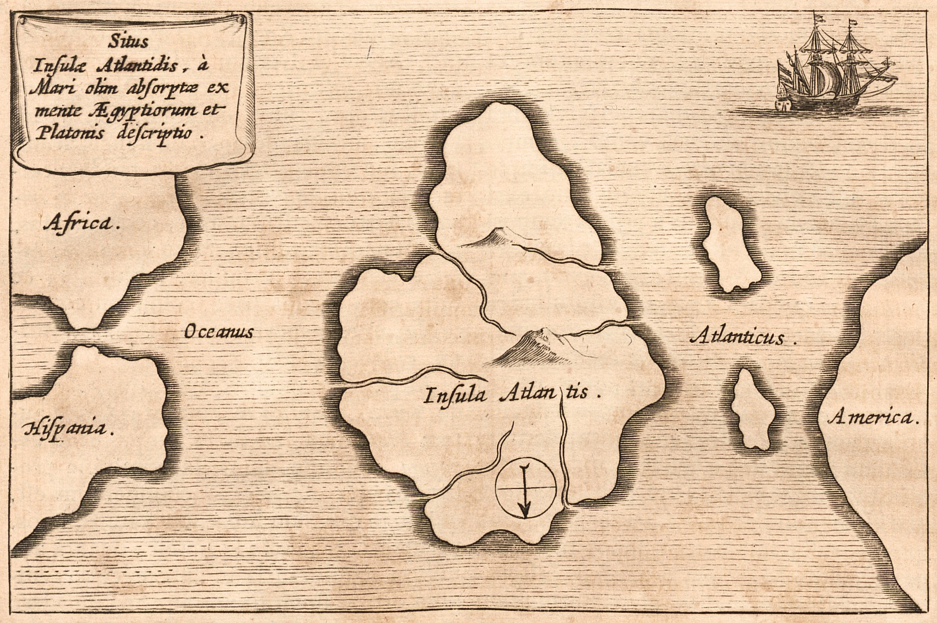
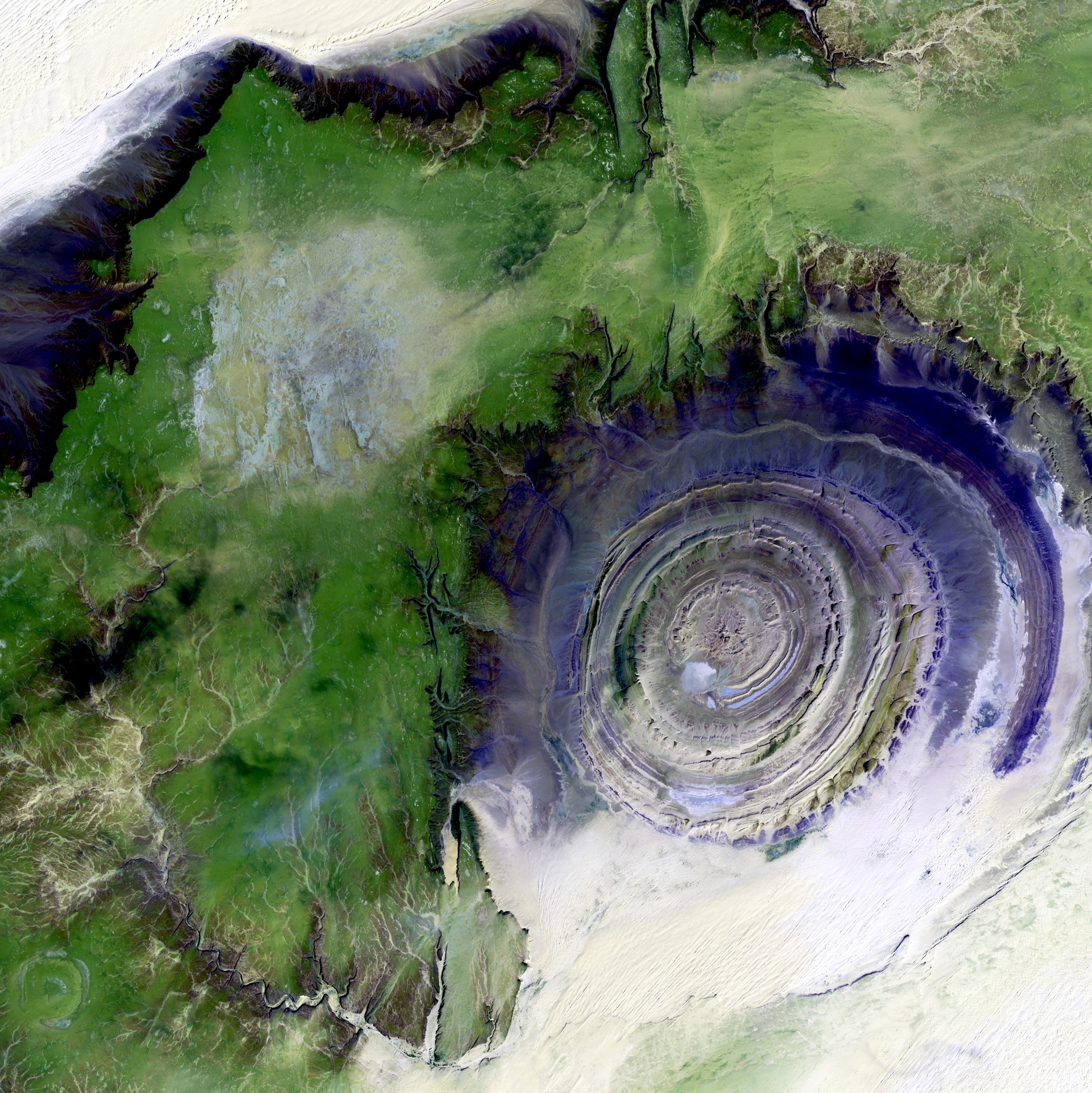
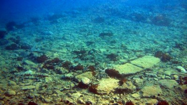
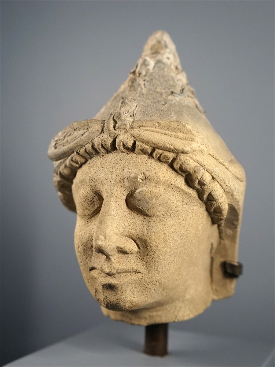
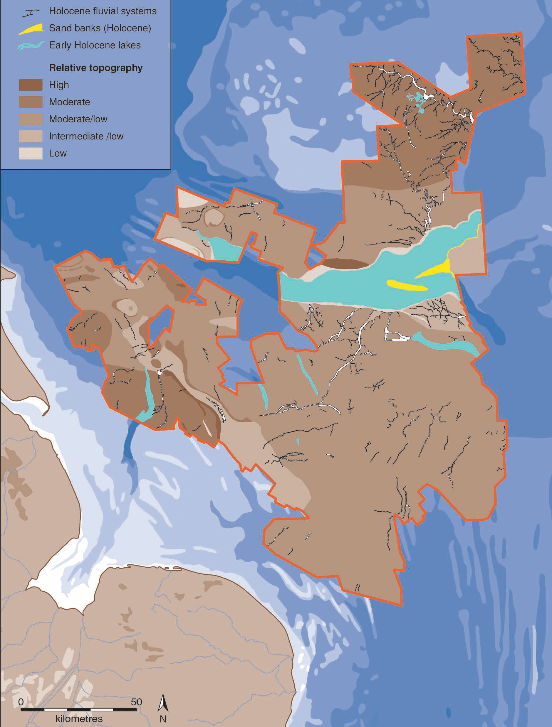
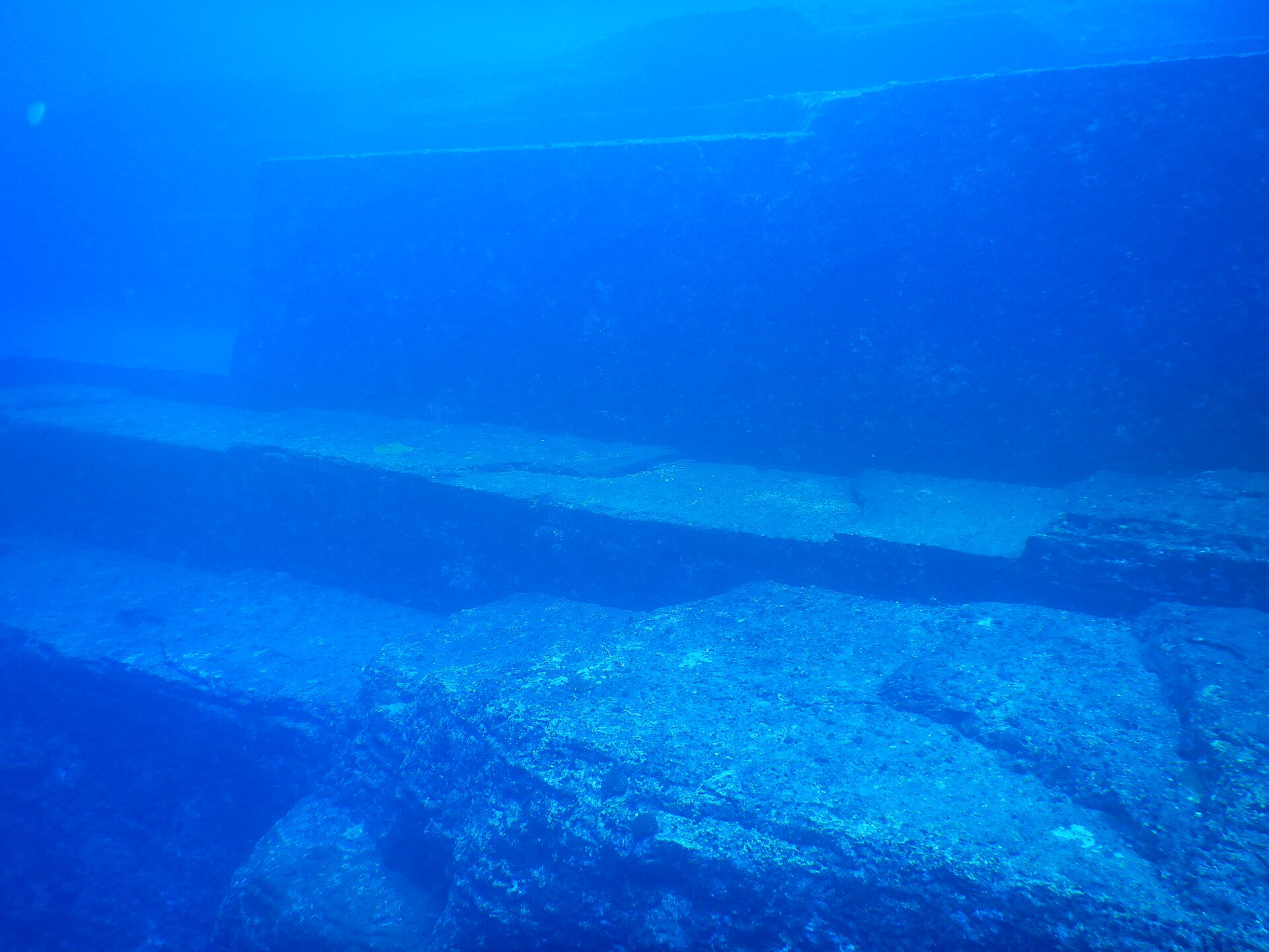
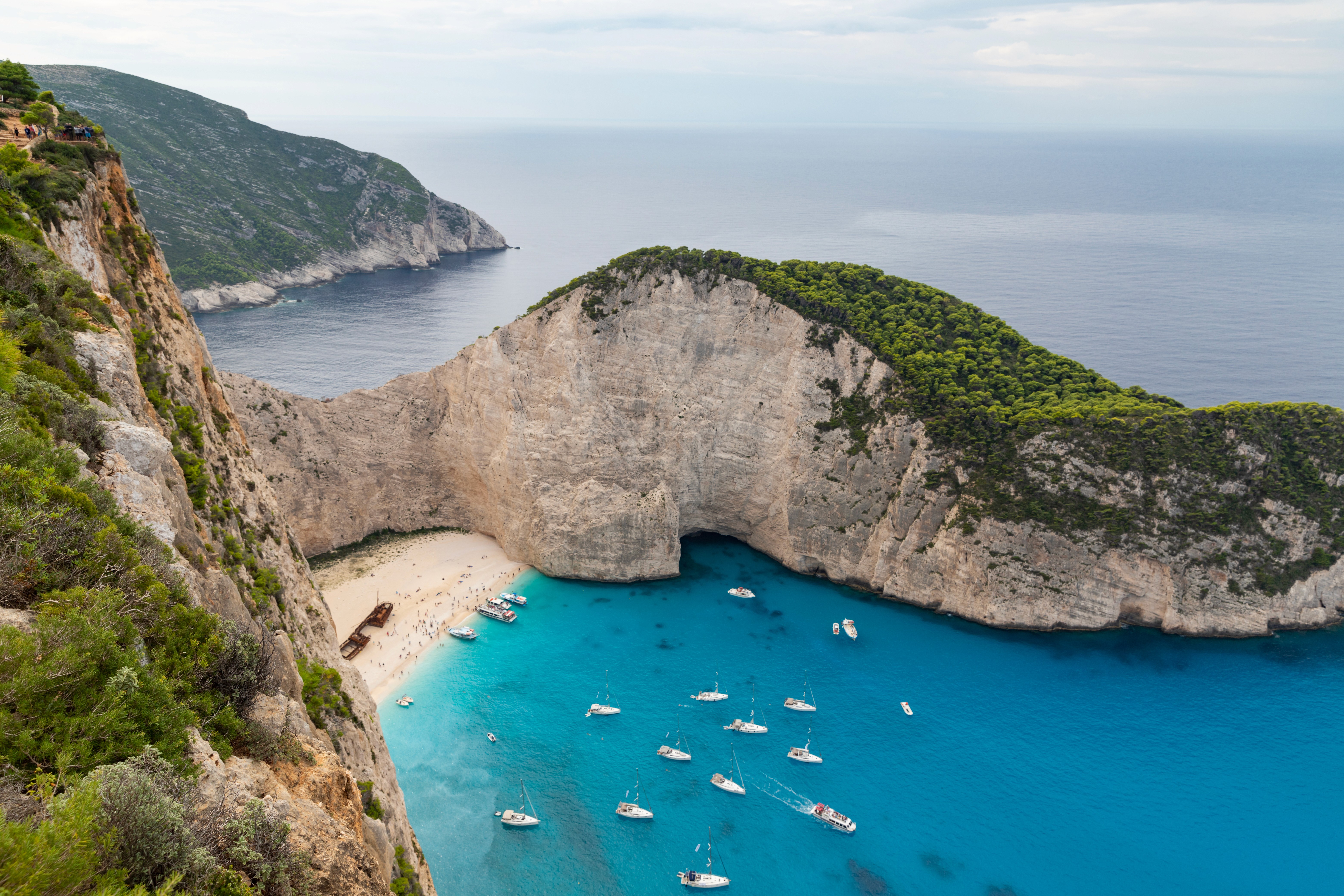
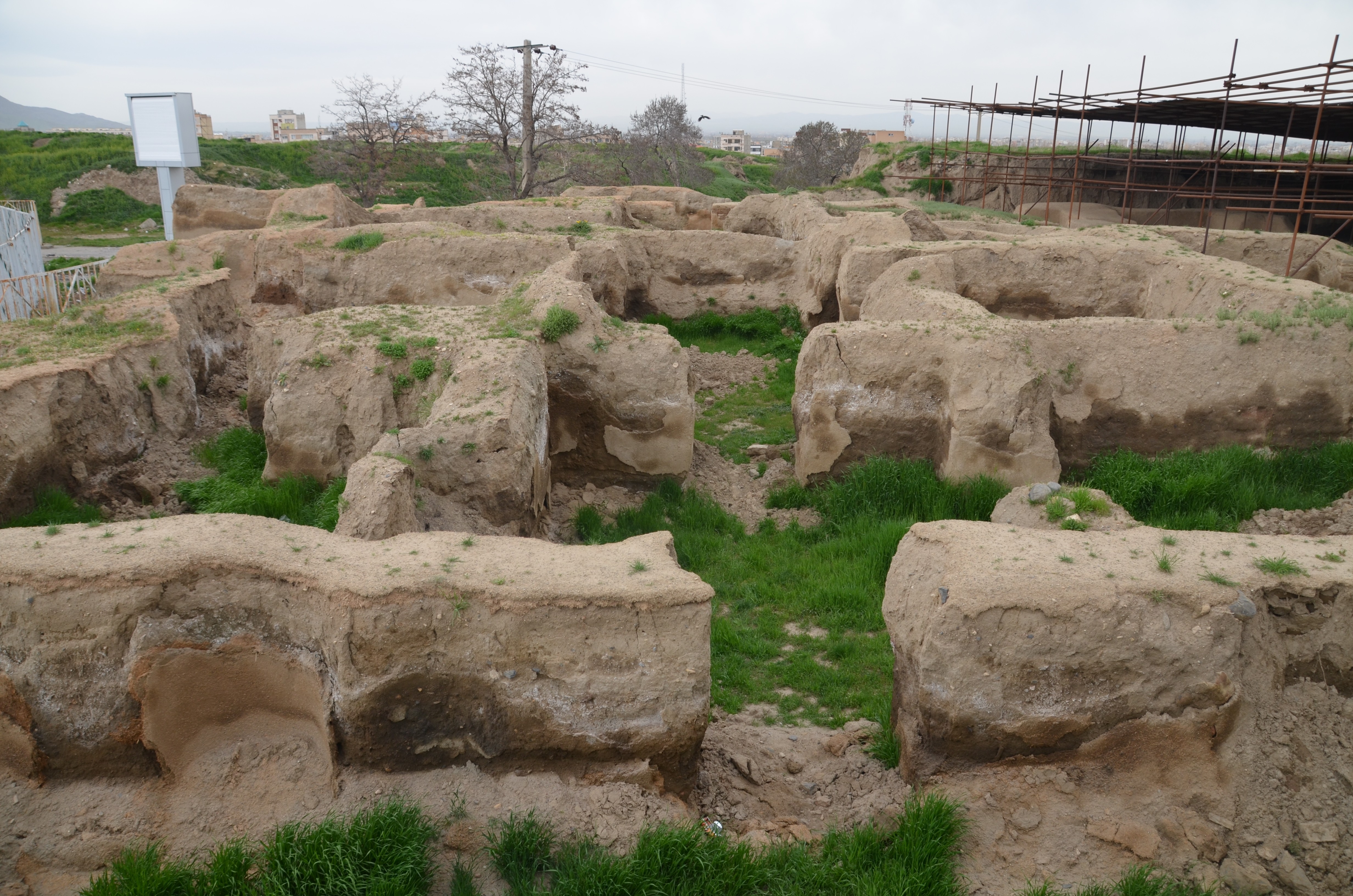
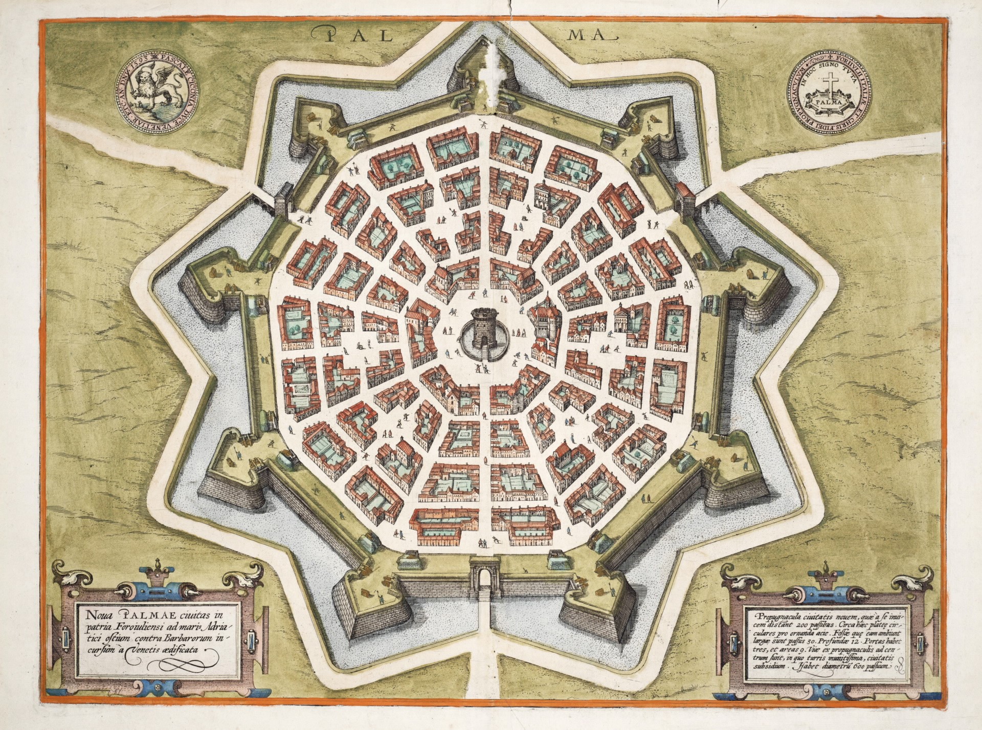
Fig. 05
Fig. 05 · Doggerland · the real lost continent

The world that drowned in human memory

Doggerland is a bathymetric reconstruction, not an archaeological site. Sonar surveys across the southern North Sea have mapped its forests, river systems, and coastal plains in enough detail that you can see the rivers Britain's modern rivers used to feed into. Vincent Gaffney's group at Bradford has been the lead voice on this for years.

Two facts about it bury most of the Atlantis literature. First: people lived there for thousands of years, and we know because the seabed keeps coughing up their tools. Second: the loss is recent enough that human cultures probably remembered it. Plato's drowned civilisation reads less like a fable and more like a story passed down a hundred generations and resurfacing as a warning.

Fig. 06
Fig. 06 · Pavlopetri & Thonis-Heracleion

The cities that meet every criterion and are still ignored

Pavlopetri's streets sit four metres below the surface, intact enough to walk through with a regulator. Thonis-Heracleion's colossal statues sit in the mud off Aboukir Bay; only about five percent has been excavated. Both are demonstrably ancient, demonstrably advanced, demonstrably submerged.

Neither is concentric. So neither competes with a Richat-Structure satellite image for search-engine attention. The popular Atlantis story isn't actually looking for a real drowned city. It's looking for something that matches the logo on the thumbnail. That's why the field's most important finds in the last fifty years live outside the conversation.

Coming next · Part 2

What the rings hide when you cut them open.

From above, it's the icon you already know. From the side — in section — it's something else entirely.

Four · The Syllabus

The sources that actually changed how we wrote this.

Curated. Not exhaustive. The full bibliography — every paper, thread, and translation we considered — lives in the Complete Research Trail, available to members.

Perseus / Tufts · open Greek + Jowett English · primary text
For when you want to read the original alongside Bury and check whether the second canal really is in there. It is.
Harper & Brothers · 1882 · scanned, full-text searchable
The book that turned Atlantis into “history.” Read the side-by-side diagrams. They look like science. That's the whole problem.
Theosophical Publishing · 1896
The “psychic” Atlantean maps. They look exactly like geology textbooks of the period. Disturbingly persuasive layout work.
Joannem Janssonium & Eliz. Weyerstr · 1665
The book with the first map of Atlantis. A Jesuit polymath trying to harmonise three flood traditions. The map is what gave Atlantis coordinates.
Encyclopedia Britannica + UNESCO Venetian Works of Defence
For the founding date and the criminals-as-first-residents detail. Both are well-documented and still wild.
c.1460 · facsimile editions; plates digitised
The original drawings of Sforzinda. The first of the perfect-star ideal cities. Look at it next to the Bury inner-city plan and Plato's geometry walks straight off the page.
BBC documentary · 2011
The footage of intact Bronze-Age streets four metres underwater. The thing nobody who's chasing rings actually wants to look at.
Institut Européen d'Archéologie Sous-Marine · ongoing
The actual archaeological site. A working port city alive in Plato's lifetime, found beneath the Mediterranean. Five percent excavated. We've been pointed at the wrong drawing.
Wikipedia entry + linked ESA imagery
The geology, the dimensions, and a clean explanation of why this is a magma dome and not a city. The answer to most of the YouTube videos about it sits in three paragraphs.
Wikipedia + USHMM source links
The history of how Atlantis-as-myth ended up funded by the SS. Worth knowing in detail before you put rings on a thumbnail.
Stanford Encyclopedia of Philosophy · peer-reviewed entry
For the long-running scholarly argument about whether Plato meant Atlantis literally or as a thought experiment. The honest answer is “we don't know,” and that ambiguity is half the reason the story survived.
University of Bradford · seismic / bathymetric survey programme
The reconstruction of Doggerland from oil-industry seismic data. Forests, rivers, coastlines — a continent rebuilt from sonar. The most “Atlantis” thing the science has ever produced, and almost nobody outside archaeology has heard of it.
Antiquity / Quaternary Science Reviews · 2003 onwards · peer-reviewed
The geophysical case that a single landslide off Norway around 6200 BC sent a wave across the North Sea that may have wiped out a quarter of Britain's coastal population. If Plato was remixing inherited memories, this is one of the events the memory remembers.
Greek Ministry of Culture · ongoing excavation since 1967
The dig file for the city most academics treated as the real Atlantis for decades. Frescoes, indoor plumbing, multi-storey buildings, all under metres of Bronze-Age volcanic ash. Read it next to Plato and you'll see what the Santorini-as-Atlantis camp was actually arguing.
Laura Spinney · Smithsonian Magazine
If you only read one thing on Doggerland, read this. Spinney walks through the survey work and what it means for how human cultures might remember a coastline disappearing.
Wikipedia entry + Robert Schoch's geological assessment
The case study for “diver finds rings, geologists explain rings, divers keep believing.” Sandstone fractures along bedding planes can look extremely man-made underwater. They aren't.
British Museum exhibition material · 2016
The accessible version of the IEASM finds at Thonis-Heracleion and Canopus. The British Museum showed roughly two hundred objects in 2016 and the public lined up. The cities exist; nobody's chasing them in YouTube thumbnails.
Chapman University · annual survey · 2016 onward
The survey that tracked belief in a real Atlantis from 40% to 57% of Americans between 2016 and 2018. This is mainstream now. That number is half the reason this video had to exist.

Want every source? The Complete Research Trail is a members-only PDF with every paper, thread, translation, and tangent we considered while making this.

LAST SUBSTANTIVE UPDATE — 2026-04-27 · CHANGELOG
Behind the scenes

Nollistudio

Research, script, host: Dami Lee. Production & post: Raffaele di Nicola.